


|
|
|
|
A Heritage at Risk from Logging, Recreation, Grazing, Mining, Road Building, Land Trades and More 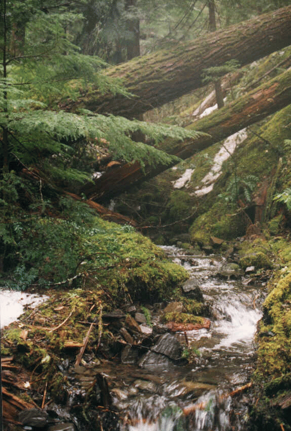
American Lands Alliance 726 7th Street SE, Washington, D.C. 20003, 202/547-9400 wafcdc@americanlands.org http://www.americanlands.org/
NATIONAL FOREST YEARBOOK 1999 Special thanks to all the organizations and individuals who contributed to this report: Alabama Environmental Council Alaska Center for the EnvironmentAlaska Rainforest Campaign Allegheny Defense Project American Lands Alliance field organizers American Wildlands Ancient Forest Rescue Aspen Wilderness Workshop Biodiversity Associates Blue Mountain Biodiversity Project Blue Mountain Native Forest Alliance Buckeye Forest Council California Wilderness Coalition Carson Forest Watch Cascadia Wildlands Project Center for Biological Diversity Central Sierra Environmental Resource Center Cherokee Forest Voices Citizens for Better Forestry Coast Range Association Colorado Wild Conservation Action Project Corvallis Area Forest Issues Group Creed Community Timber Watch Dick Kramer Doug Cornett Deerlodge Forest Defense Fund EarthJustice Legal Defense FundThe Ecology Center Ecosystems Equity Council Florida Sierra Club Forest Watch Forest Guardians Forest Issues Group Frank Welsh Friends Aware of Wildlife Needs Friends of the Bitterroot Friends of the Clearwater Friends of Nevada Wilderness Georgia Forest Watch Grant County Conservationists Greg Dyson Heartwood Hells Canyon Preservation Council High Uintas Preservation Council Indiana Forest Alliance Jerry Majerus John Hiatt Kentucky Heartwood Kettle Range Conservation Group Klamath Forest Alliance Klamath-Siskiyou Wildlands Center The Lands Council Leavenworth Audubon Adopt-a-Forest Marge Sill Maricopa Audubon Society Mendocino Environmental Center Methow Forest Watch Missouri Heartwood Montana Wilderness Association National Audubon Society Newton County Wildlife Association North Carolina Sierra Club Northwest Ecosystem Alliance Northwoods Wilderness Recovery Oregon Natural Resources Council Ouachita Watch League Prescott National Forest Friends Protect Our Woods Quilcene Ancient Forest Coalition Regional Association of Concerned Environmentalists Rio Grande Chapter Sierra Club San Juan Citizen 's AllianceSave Our Canyons Sequoia Forest Alliance Sierra Nevada Forest Protection Campaign Sierra Club - Alaska Office Sierra Club - Angeles Chapter The Siskiyou Project Sky Island Alliance South Carolina Coastal Conservation League South Carolina Forest Watch Southern Utah Wilderness Alliance Southwest Forest Alliance Superior Wilderness Action Network (SWAN) Tall Timbers Research Texas Committee on Natural Resources Umpqua Watersheds Inc. Upper Arkansas and South Platt Project Utah Environmental Congress Vernon Bates Vince Bellis Virginians for Wilderness West Virginia Sierra Club Western Colorado Congress Western North Carolina Alliance White Mountain Conservation League Wild Utah Forest Campaign Wild Alabama The Wilderness Society WildlawWillets Environmental Center Wyoming Outdoor Council Wyoming Sierra Club All maps courtesy of the U.S. Forest Service. All photos by Steve Holmer Except North Winberry by Jeremy Hall and
THE 1999 NATIONAL FOREST YEARBOOK: A Heritage at Risk from Logging, Recreation, Grazing, Mining, Road Building, Land Trades and More Introduction: A Resource At Risk This National Forest Yearbook is our first attempt to catalogue the threats facing all 154 of the National Forests in the United States. The Yearbook presents a picture of an enormously valuable National Forest System. Clean lakes and rivers, productive grasslands and scenic mountains, and abundant fish and wildlife characterize the National Forests. Many of the descriptions of these Forests also capture their popularity for fishing, camping, hiking, and solitude, and explain some of the multiple "ecosystem services" that they provide. The account of the National Forest System presented by this Yearbook also documents clearly how these assets are at risk. The importance of Chief Dombeck's Roadless Area Moratorium notwithstanding, environmentally insensitive timber sales threaten a majority of the nation's National Forests. Why must lynx habitat, trout streams, old growth forests, and rare plants be at risk from logging of the National Forests that we the public own? An aspect of the timber sale program that becomes apparent from even a quick reading of the Yearbook is how many timber sales are justified in the name of ecological "restoration," wildlife protection, or "forest health." Sometimes this is because decent land managers seek revenue to undertake desirable projects, and fall victim to the Knutsen-Vandenburg (KV) law or other perverse incentives that promote logging to gain revenue from timber sale receipts. Other times, it is old-school land managers who come up with creative ways to justify more "business as usual" timber sales. Close on the heals of logging as a threat to the National Forests is recreation. This yearbook documents the growing threat that off road vehicles (ORVs), ski resort expansions, and privatization pose to the National Forests, as well as the problems that result simply from budgets that are inadequate to maintain facilities for reasonable and appropriate recreational use. The issue of budgets, generally, is another recurrent theme in the Yearbook's entries. Too often, the Forest Service budget misserves the public and the land by starving programs that desperately need funding, while promoting a timber sale program that subsidizes irresponsible logging that would not otherwise occur. As the Administration prepares its FY 2001 budget, we urge attention to the examples in the Yearbook that illustrate how dollars drive bad management decisions. Proposed NFMA Regulations: The Wrong Answer Finally, the Yearbook makes an irrefutable case against the proposed National Forest Management Act (NFMA) regulations now pending that would increase discretion by Forest Service land managers and remove provisions for citizen enforcement. All of the leadership from Chief Dombeck and so many capable Forest Service employees aside, this is the wrong time to give the agency additional discretion "on the ground." Every page of the Yearbook is replete with examples where existing discretion is being abused by local timber sale planners, line officers, and other decision makers. Timber sales where they shouldn't be, ORVs out of control, lack of attention to wildlife needs, and countless other environmental abuses occur every day on our National Forests. Please consider that this Yearbook is not a description of sins from the agency's dark past, but rather a description of current projects, moving forward right now in specific National Forests, at the initiative of local Forest Service land managers or with their permission. The accounts in this Yearbook are a powerful argument against amending NFMA regulations to give more discretion to agency land managers. Whatever their good points, the NFMA regulations proposed this October will be a disaster if they are implemented as written, giving the same land managers who are responsible for the abuses described in this Yearbook even more discretion than they have now. The Yearbook describes many instances where bad projects have been altered, postponed, or dropped after citizens used their rights of administrative and legal appeal under the current NFMA regulations to insure that however weak existing standards are, they are nonetheless observed. The Yearbook makes clear that the key to better National Forest management is not to remove provisions for enforcing agency accountability, but rather to shift the focus (and resources) of the agency to landscape restoration rather than commodity production. We give Chief Dombeck and many others in the agency great credit for trying to steer the ship the right direction. But no one realizes better than Chief Dombeck how many perverse incentives influence local Forest Service decision makers to identify logging as the solution to every problem. The KV fund mentioned above is just one of several "Swiss Bank Accounts" that put about 1/3 of Forest Service's spending off-budget. A related issue is payments from timber receipts to counties for roads and schools. Chief Dombeck and the Clinton Administration correctly seek reform of this program to "decouple" payments to counties from timber receipts. Unfortunately, legislation recently approved by the House of Representatives would not only continue the current linkage, but even create new off-budget funds. The same politically powerful coalition of local officials, schools, and timber companies that successfully lobbied the House is present in every logging community to pressure local Forest Service land managers to sell more timber. No, it's not time to rewrite the NFMA regulations to give the agency more discretion until these perverse incentives are removed and other steps are taken toward responsible management of the National Forests. Indeed, the Yearbook makes clear the case for standards for Forest Service plans and project decisions that are enforceable by citizens and the courts. Strong NFMA regulations are needed to insure that Forest Plans address such issues as suitability of lands for grazing, species viability, the impact of invasive species, controls on ORVs, Wilderness recommendations, and others. We pledge to work with the Chief and the Administration to write NFMA regulations that tackle these serious problems. Thankfully, there are several positive policy initiatives pending that will address the threats facing the National Forests that are outlined in this Yearbook. On October 13, 1999, President Clinton announced the initiation of a process for administrative rule-making to protect National Forest roadless areas. We urge the immediate protection of all 60 million acres of current National Forest roadless areas, including the Tongass National Forest in Alaska and all roadless areas of 1000 acres in size or larger or of ecological significance. This protection should include not just prohibitions against roadbuilding, but also commercial logging conducted without roads, ORV use, mining, and grazing. Also pending is a companion "roads policy" that was promised by Chief Dombeck upon the promulgation of the Roadless Area Moratorium last February. This policy should provide clear direction to National Forests for prioritizing road removal based on wildlife, clean water, and other environmental needs, and insure that standards are met for proper work. Also, important decisions are pending on the Administration's "ecosystem management" plans for the National Forests in the Pacific Northwest, the Northwest Forest Plan and the Interior Columbia Basin Ecosystem Management Plan (ICBEMP). A Supplemental Environmental Impact Statement (SEIS) is now under consideration on revisions to the "survey and manage" requirements under the Northwest Forest Plan, affecting 17 National Forests in northern California, Oregon, and Washington State west of the Cascades. American Lands and other national and regional groups are urging that an alternative to end old growth logging under the Plan be considered and adopted in the SEIS. It is anticipated that a new SEIS for ICBEMP, affecting virtually 25% of the National Forest system in an area in eastern Washington, Oregon, Idaho, and Montana, will be available for comment soon. Protection of old growth, impacts of grazing, and aquatic conservation are all key issues that must be addressed in ICBEMP. Finally, environmental groups have taken the initiative themselves to file a petition with the Forest Service to request administrative rule-making for more effective regulation of ORVs. The Wildlands Center for Preventing Roads, The Wilderness Society, and 90 other groups including American Lands filed the petition December 9, seeking new Forest Service rules to prohibit cross-country travel in National Forests by motorized vehicles, and insure that ORV routes are designated only where the Forest Service can demonstrate that adverse environmental impacts will not occur. This Yearbook is our first comprehensive report on all of the units in the National Forest System. The next Yearbook, we hope, will demonstrate significant progress in addressing many of the current threats to these valuable public lands.
ALABAMA Bankhead National Forest
Continued logging and conversion of natural forests into pine plantations (tree farms) are the biggest threats to the forest. There is also a potential threat from land exchanges in the southern part of the forest which is coveted by the coal mining industry. CONTACT: Lamar Marshall, Wild Alabama, 256-974-6166, waruk@aol.com Talladega National Forest The Talladega National Forest covers 387,000 acres and is divided into two sections located in central Alabama. It is a mixed hardwood-pine forest with one wilderness area, the 7,245 acre Cheaha Wilderness. Almost half of the wilderness area was recently burned by arsonists; fires were started along a closed road. Arsonists also set fire to a proposed wilderness or scenic area. The Talladega is now undergoing a Forest Plan revision that could determine whether these areas are protected. The forest is threatened by continued logging, and arsonists who are still at-large. Another emerging problem is that the wilderness area is experiencing too much recreation threatening its natural character and opportunity for solitude. CONTACT: Ken Wills, Alabama Environmental Council, 205/322-3126 Conecuh National Forest The Conecuh National Forest covers 83,000 acres in southern Alabama on the Florida border. The Conecuh contains southern coastal plain pine forest, pitcher plant bogs and hardwood swamps. Like other forests in the southeast, the Conecuh is now undergoing revision of its Forest Plan which could lead to better management, or continuation of the current timber program which is converting natural forests into pine plantations. Logging and conversion to pine plantations continue to be the primary threats to this forest. CONTACT: Ray Vaughn, Wildlaw: 334/265-6529, wildlaw@wildlaw.org Tuskegee National Forest The 11,000-acre Tuskegee National Forest located in east-central Alabama is the smallest in the nation. The Forest Service has admitted that it has replaced much of the native longleaf pine ecosystem with slash pine. There has not been much logging in recent years but the Tuskegee is now undergoing a Forest Plan revision. The new Forest Plan could be good or bad for the Forest depending on what priorities are chosen. Conservationists recommend that the new Plan focus on restoring the longleaf pine ecosystem. CONTACT: Ray Vaughn, Wildlaw, 334/265-6529, wildlaw@wildlaw.org ALASKA Alaska 's coastal temperate rainforest, stretching 1,000 miles from Ketchikan to Kodiak, harbors the last large unfragmented stands of centuries-old trees and abundant wildlife that once blanketed the entire Pacific Northwest coast. The vast majority of this rainforest lies within the Tongass National Forest. Unfortunately, Alaska's powerful congressional delegation has repeatedly tried to increase subsidized clearcutting in Alaska=s rainforest and give away Alaska's National Forest lands to the State of Alaska or private interests.Tongass National Forest The 17-million-acre Tongass National Forest was left out of the Clinton Administration 's 18-month moratorium on new logging roads in National Forests. Yet it is being damaged by unsustainable levels of old-growth clearcutting and road-building, fueled by more than $30 million a year in taxpayer subsidies. Many nationally-respected scientists have warned that continued logging and road construction on the Tongass will imperil wildlife, such as the grizzly bear and wolf, that require large expanses of old-growth forest to survive.The 1999 revised Forest Service 10-year management plan for the Tongass protects some areas important to local communities but leaves large blocks of pristine old-growth roadless areas vulnerable to damaging clearcutting and road-building. The new plan calls for subsidizing a new high volume, veneer peeler/sawmill/chipper operation being promoted by the Alaska congressional delegation. Chugach National Forest The Chugach includes natural areas of national significance such as Prince William Sound which is still recovering from the Exxon Valdez oil spill. The spill killed more wildlife than any environmental disaster in our nation 's history. Ten years later only two of 28 injured species and resources have recovered.To the east, the Copper River Delta is internationally recognized as a migratory haven for shorebirds and home to healthy runs of wild Copper River Red salmon, one of the finest wild salmon runs in the world. Unfortunately, these areas and all 98% of the Chugach that is currently wild and undisturbed by roads are open for development because Congress has yet to designate a single acre of the Chugach as legally-protected wilderness. The Alaska Rainforest Campaign (ARC) is a coalition of national and Alaska-based conservation groups working to protect the Tongass and Chugach National Forests. In addition to trying to influence the new Forest Plans and stop damaging bills and riders by the Alaska delegation, ARC member groups are working to influence the Clinton Administration to adopt a national policy to protect all National Forests including the Tongass and Chugach. CONTACTS: Alaska Rainforest Campaign, 202/544-0475 Karen Button, Alaska Center for the Environment, 907/274-3662 Sally Kabisch, Sierra Club, Alaska Rainforest Office, 907/235-2896 ARIZONA Grazing and old growth logging are the greatest threats to native species and wilderness in the Southwest. Excessive grazing throughout the Southwest has pushed the importance of protecting native fish species and the Southwest willow flycatcher into the forefront. Coconino National Forest The Coconino National Forest is dominated by small diameter trees, with only 4 percent of the forest supporting mature ponderosa pine. The Coconino National Forest was heavily high graded for 100 years by railroad logging and large volumes were logged in the 1970's and 80's. The vogue justification for logging on the Coconino is "restoration" logging. The goal is to recreate the tree density and location that existed in pre-European times. This form of logging removes between 80 and 90% of the trees from the site creating what looks essentially like a clearcut.The largest restoration project proposed thus far calls for cutting 15-25 million board feet of timber in a 5,000 acre area near the city of Flagstaff - the largest timber sale in northern Arizona in more than a decade. The conservation community recommends the following guidelines for restoration projects: 1) move toward an ecosystem that is dominated and shaped by natural ecological processes, especially fire; 2) restoration should apply a conservative approach that includes prescribed fire and thinning of only very small diameter trees; under no circumstances should trees greater than 16" diameter at breast height be cut; and 3) extensive ecological research needs to be completed on initial experiments prior to moving onto large scale projects. CONTACTS: Sharon Galbraith, Rio Grande Chapter of the Sierra Club, 520-774-1571 Martos Hoffman, Southwest Forest Alliance, 520-774-6514Brian Segee, Center for Biological Diversity, 520-623-5252, ext. 308 Forest Guardians, 505-988-9126 Kaibab National Forest The Kaibab National Forest is split in two by the Grand Canyon, creating a north and a south Kaibab. The north Kaibab is home to the densest breeding population of Northern goshawk in North America and has the largest contiguous blocks of old growth ponderosa pine in the Southwest. The boundaries of the Kaibab National Forest are also the boundaries of the Grand Canyon Game Preserve which was designated in 1907 by President Theodore Roosevelt. This designation does not allow mining on the forest. Though this forest is Game Preserve, litigation has been necessary to make wildlife habitat protection a priority. The south Kaibab is heavily logged and roaded due to the accessibility to the railroads, while the inaccessible North Rim wasn't heavily logged until the 1970's and 80's. Trees over 28" in diameter were not logged until after World War II. In response to a lawsuit by the Center for Biological Diversity, the Forest Service must designate old growth blocks in 20 percent of every forest in the Southwest Region to protect Northern goshawk and Mexican spotted owl habitat. At one time 15% of the forest was set aside into old growth blocks, but a recent Forest Plan amendment dissolved these old growth allocations and opened them up to logging. A Forest Service working group is in the process of determining the location of old growth blocks on the north Kaibab. Several large timber sales are planned for the north rim of the Grand Canyon. The Dry Park Timber Sale is proposed to log up to six million board feet and the East Rim Timber Sale is proposed to log 15 million board feet. Both sales include old growth ponderosa pine. The Kaibab National Forest continues to log old growth ponderosa pine, despite its rarity in the Southwest. These timber sales will impact the Mexican spotted owl on the Kaibab Plateau. The Forest Service is required to designate Protected Activity Centers (PAC's) for the Mexican spotted owl, based on current and historic nesting sites. The Forest Service claims that spotted owl nests do not exist on the Kaibab Plateau, despite the historical record. CONTACTS: Sharon Galbraith, Rio Grande Chapter of the Sierra Club, 520-774-1571Martos Hoffman, Southwest Forest Alliance, 520-774-6514, Brian Segee, Center for Biological Diversity, 520-623-5252, ext. 308 Apache-Sitgreaves National Forest The Apache National Forest contains steep rugged canyons and lots of water. Due to its rugged terrain, the Apache has not been logged as much as the Sitgreaves National Forest, which has been heavily logged and roaded due to its flat terrain and proximity to Flagstaff and the railroad. Excessive logging has caused the Sitgreaves to become a poor habitat for the Northern goshawk. The Arizona Game and Fish Department found that Northern goshawks are immigrating to the Sitgreaves but are dying soon after their arrival. The predominant issue on the Apache-Sitgreaves National Forest is grazing. There are currently 10 grazing permits up for renewal. Cows have greatly impacted the Forest. New allotment management plans have reduced cow/calf pairs, but the numbers of livestock are still too high. There are currently no plans to rest allotments. Grazing on the Apache-Sitgreaves National Forest is also impacting the habitat of the Southwestern willow flycatcher, Mexican spotted owl and Northern goshawk. There are nineteen wolves on the Apache and fourteen more wolves were recently released as part of a federal reintroduction program. CONTACTS: Liz Wise, White Mountain Conservation League, 520-537-1978 Martos Hoffman, Southwest Forest Alliance, 520-774-6514 Brian Segee, Center for Biological Diversity, 520-623-5252, ext. 308 Prescott National Forest Livestock grazing is a serious threat on the Prescott National Forest. The Wilderness Society and the Sierra Club recently filed a lawsuit regarding rangeland suitability. There is also growing conflict between hikers and off-road vehicles (ORVs) on the Prescott National Forest. Recent Forest Plan changes have been made to accommodate ORVs. CONTACTS: Jim Powers, Prescott National Forest Friends, 520-776-1552 Martos Hoffman, Southwest Forest Alliance, 520-774-6514 Tonto National Forest Forests are rare on the Tonto National Forest covering only 15 to 20 percent of the landscape. Small stands of ponderosa pine are islands surrounded by desert. These unique forests are beautiful and provide ecologically rare habitats. The Honey Timber Sale has been proposed for an area that borders on the Saleis-Salome and the Sierra Ancha Wilderness Areas. This timber sale is within Northern goshawk habitat. Heavy cattle grazing is having serious impacts on both campgrounds and endangered species on the Tonto. Efforts have been made to remove cattle from the Verde and Tonto Rivers to protect bald eagles and preserve water quality for the loach minnow and spikedace. Grazing along these rivers severely impacts riparian areas. CONTACTS: Bob Witzeman, Maricopa Audubon Society, 602-840-0052, witzeman@worldnet.att.netFrank Welsh, 602-277-5080 Brian Segee, Center for Biological Diversity, 520-623-5252, ext. 308 Coronado National Forest The Coronado National Forest is in the United States portion of the Sky Island region, which spans into Mexico. The Coronado National Forest has the greatest diversity of ants, mammals, and reptile species in the U.S. The landscape from low to high elevations includes semi-desert and plains grasslands, oak woodlands, pinion/juniper forests, ponderosa pine, and spruce and fir forests. There is no timber sale program on the Coronado National Forest but grazing is extensive. A high percentage of the forest is overgrazed. Cattle have been very destructive of riparian areas and have impacted Southwestern willow flycatcher habitat. Recreation, motorized as well as non-motorized, is an increasing threat on the Coronado. There has been an increase of Off Road Vehicle (ORV) use on the forest. Recreation developments are a major threat as the Forest is trying to meet the needs of more than 200,000 hikers using the Coronado. A proposed campground in the Pinaleno Mountains would adversely impact the Apache goshawk habitat. CONTACTS: Andy Holdsworth, Sky Island Alliance, 520-327-1129 Brian Segee, Center for Biological Diversity, 520-623-5252, ext. 308 ARKANSAS Ouachita National Forest Established in 1907, the Ouachita is the South's oldest and largest National Forest. It includes about 1.7 million acres located in the Interior Highlands of west-central Arkansas and southeast Oklahoma. The Ouachita has only seven small wilderness areas totaling 63,254 acres but more than 2,000 native plant species. Primarily covered with a mixed oak-pine-hickory forest, the timber base is being converted to pine by the use of herbicides and repeated prescribed burns. The Ouachita contains an astonishing 6,000 miles of roads. A recent land exchange with the Weyerhaeuser Company added more unmaintained roads and 140,000 acres of primarily failed plantations of non-native loblolly hybrids, dry rocky areas, and heavily cut-over lands. The public is now responsible for maintaining these roads and restoring the area. CONTACT: Vernon Bates, 615-646-6543; Al Brooks, 501-637-4471 Jerry Williams, 501-767-2274, Ouachita Watch League Ozark National Forest The Ozark National Forest comprises five separate sections and covers more than one million acres, located mostly in northwest Arkansas. Hardwoods occupy 65 percent of the forests with the oak-hickory type dominant. The forest has five wilderness areas totaling 65,826 acres. The Ozark is now undergoing a Forest Plan revision. Local activists are attempting to implement a Citizens' Management Alternative, which is based on restoration forestry and a conservation biology core-buffer-corridor model that will create a system of protected reserves. The primary threat to this forest is logging. The Forest Service is logging the Headwaters area of the forest which contains the headwaters for six National Wild and Scenic Rivers. There are also remnant areas of old-growth forest, with trees in the 300-400 year old age class, which the Forest Service is targeting for logging. CONTACTS: Hal Kuff, Newton County Wildlife Association, 870/861-5600 Simon Overbey, Newton County Wildlife Association, 870-861-5600 St. Francis National Forest Covering 21,000 acres, the St. Francis is located on the east-central edge of Arkansas consisting of mixed pine and a variety of bottom land hardwoods. The major threat to this Forest is continued logging. CONTACT: Hal Kuff, Newton County Wildlife Association, 870/861-5600 CALIFORNIA Eighteen National Forests make up 20 million acres of federally owned land in California. They are located in the North Coast, Cascade, and Sierra Nevada ranges and from Big Sur to the Mexican Border in the South Coast range. National Forests in California account for 25 percent of National Forest recreation nationwide and about half of the public wildland recreation in the state. National Forests have 30 percent of the family campgrounds, 4.3 of the 6.5 million acres designated as Wilderness, and 22 of 33 major downhill ski areas in California. They also include more than 2,400 lakes and reservoirs, 13,000 miles of fishable rivers and streams, 1,200 miles of designated Wild and Scenic rivers, and 10,500 miles of maintained trails for hiking, horseback riding and off-road vehicles. National Forests in California contain such unique scenic areas as Mt. Shasta, Lake Tahoe, Mt. Whitney, and the Big Sur Coast as well as important ecological and prehistoric sites. More than 600 of the 800 species of fish and wildlife in California live on National Forests, making the Forest Service the single largest habitat manager in the state. In addition, California National Forests are home for nearly 4,000 of the 6,500 native plants in California. Recovery programs include protection of Critical Habitat for threatened and endangered species such as the California condor, the California bighorn sheep, and the northern spotted owl. Other imperiled species include marbled murrelet, wolverine, pine marten, Pacific fisher, and salmon. Sierra Nevada Region Wide Planning The Sierra Nevada, christened the "Range of Light" by conservationist John Muir, is a large and distinct ecological and cultural region. Reaching from Lassen Volcanic National Park in the north to the Sequoia National Forest in the south and from the grassland and oak woodlands of its western foothills to its eastern juncture with the Great Basin, the Sierra Nevada encompasses many well-known areas including Yosemite and Sequoia-Kings Canyon National Parks, Mono Lake National Scenic Area, and the Ansel Adams and John Muir Wilderness Areas. In 1990, the eleven Sierra Nevada National Forests drafted management plans governing the lands they manage: what areas would be managed to protect wildlife, what should be off limits to logging, where the concern should be scenic views, and other issues. Since that time, new scientific information has shown that these plans are inadequate to protect the ecosystem and that the web of life in the Sierra Nevada may be unraveling. The Sierra Nevada Ecosystem Project (SNEP) and other studies found that: *"Rivers and streams are the most altered and impaired habitats of the Sierra. " As a result fish, frogs, toads, birds like the willow flycatcher, and other creatures which need a healthy stream or streamside area or meadows are dramatically dropping in population.*The amount of old-growth forest has drastically declined, and with it essential habitats for many species. Because of the loss of ancient forests across the range, forest carnivores such as the wolverine, the Sierra Nevada red fox, and two small, furbearing mammals - the American marten and Pacific fisher - are disappearing. *Bighorn sheep are close to extinction in the Sierra Nevada. *The enormous Forest Service road system in the Sierra Nevada (more than 26,000 miles in length) causes water quality problems, destroys spawning grounds for trout and salmon, fragments habitat, and increases invasions by noxious weeds and other unwanted species. Because of these and other findings the Forest Service announced a new process last year which will lead to a master plan for managing and protecting the ancient forests, wild roadless lands, rivers and streams and wildlife of the Sierra Nevada National Forests. The Service is currently preparing a Draft Environmental Impact Statement for this Sierra Nevada Forest Plan.
*Protect the Feather River, the American River, and streams and rivers between the Oregon border and the Sequoia National Forest. All watercourses in the Sierra Nevada should be protected from logging and grazing by buffers along streams and rivers. *Permanently preserve the last of all ancient forests in the Sierra Nevada *Stop all road building in Sierra Nevada National Forests and obliterate roads causing damage to streams and rivers. Roads necessary for safety should be maintained to prevent erosion. *Permanently protect all roadless areas including those smaller areas (less than 5,000 acres) that have important biological, cultural, and historical value. *Protect habitat for species that are disappearing from the Sierra Nevada including; big horn sheep, salmon, spotted owls, red foxes, goshawks, fishers, martens, wolverines, native frogs and toads, and the willow flycatcher. *Protect the quality of water supplying 60% of California 's needs.*Make ecosystem protection and restoration the highest priority on National Forest lands CONTACT: Scott Hoffman Black, Sierra Nevada Forest Protection Campaign, 916/442-3155, Fax: 916/442-3396, http://www.sierraforests.org/ Quincy Library Group Project : Plumas, Lassen, Tahoe National ForestsIn December 1998, the Forest Service commenced the planning process for the Quincy Library Group (QLG) Forest Recovery Act. Despite the hard work of conservation groups who opposed the bill, it passed after being attached to the Omnibus Appropriations bill in the final minutes of the 105th Congress. The bill covers the Sierra Nevada's Plumas, Lassen, and part of the Tahoe National Forests that together make up more than 2.5 million acres of publicly owned land. The Forest Service has estimated that the QLG Act has the potential to result in tripling road construction on the three affected National Forests. The Forest Service recently released the final the Environmental Impact Statement for the Quincy Plan. The propose Plan would double the amount of logging in the region. Conservationists have appealed the decision. A sound management alternative would include: *Protection of 59,000 acres of old growth forest identified in the Sierra Nevada Ecosystem Project (SNEP) report. These areas are not identified for protection in the QLG. *Full protection of riparian areas, based on the strategy outlined in the Sierra Nevada Ecosystem Project Report. *Protection of all roadless areas, small and large. The QLG would defer logging in some (but not all) roadless areas greater than 5000 acres, but neither provides protection for smaller roadless areas nor permanent protection. *Minimize intensive logging practices. The QLG calls for 40-60,000 acres of 1/4 mile Defensible Fuel Profile Zones (DFPZs) across the landscape, and for group selection logging on .57 percent of the pilot project area per year (more than 9000 acres) that could cause serious habitat fragmentation. CONTACT: Scott Hoffman Black, Sierra Nevada Forest Protection Campaign, 916/442-3155, http://www.sierraforests.org/ Lassen National Forest Logging continues to threaten the Lassen National Forest. The proposed Castle Rocks Project would remove 10.5 million board feet of sawlogs and 1.5 million board feet of biomass products from 1,099 acres of the upper Soda Creek watershed and will have a noticeable, immediate impact on sensitive species known to inhabit the project area. In the recent past there have been consistent sightings of California spotted owl, goshawk, and marten in the project area; there is a designated furbearer corridor for marten running directly through the project; and there is a designated habitat for spotted owls adjacent to the project area. This project would disrupt reproduction and dramatically increase fragmentation of habitat of spotted owls within the analysis area, continuing their documented nine-year accelerating decline on Lassen National Forest. Within or adjacent to the project area are parts of three well-used hiking trails all of which enter pristine roadless area. Agency plans to retain "character" trees along the trails will not alleviate the change in scenery from natural forest to one with stumps, slash piles, and skid trails as a result of logging. CONTACT: Scott Hoffman Black, Sierra Nevada Forest Protection Campaign, 916/442-3155 Tahoe National Forest Located in eastern California, the Tahoe National Forest straddles the north central Sierra Nevada mountains, between Reno, Nevada, and Sacramento, California. More than 140 years of mining, along with logging, grazing, ski resort development, and other activities in Tahoe have had major impacts on forest, aquatic, and riparian ecosystems. The Forest Service is proposing to use herbicides to kill brush and speed conifer growth in areas affected by large forest fires in the Tahoe National Forest. The project would mark the first large-scale use of herbicides on the district since the early 1980s. The Forest Service will use the chemicals glyphosate and triclopyr to remove brush. Local conservation groups have argued that the chemicals have serious environmental side effects and that brush fields are beneficial to conifer growth. Although its direct toxicity to mammals and birds may be low, glyphosate (the main ingredient in RoundUp) is poisonous to amphibians, fish, and invertebrates. In addition, these chemicals pose unacceptable risk to humans. CONTACT: Don Jacobson, Forest Issues Group, 530/272-1433, dj@oro.net Klamath National Forest Located in northern California on the Oregon border, the Klamath contains 25 species of cone-bearing trees on 1,700,000 acres with five wilderness areas; Marble Mountains, Trinity Alps, Russian, Red Butts and Siskiyou. The Upper South Fork Timber Sale as one of many roadless areas under threat nationwide despite the current roadbuilding moratorium. Home to one of the largest populations of spring chinook salmon remaining in California, the Forest Service plans to log near the South Fork Salmon River, a key watershed. The sale contains four units in the Orleans Mountain Roadless Area, and borders the Trinity Alps Wilderness Area. Proposed as a fuels reduction project, the sale will target the last remaining scattered old growth stands in the area which are important Del Norte Salamander habitat. CONTACT: Kyle Haines, Klamath Forest Alliance, 530/467-5405, klamath@sisqtel.net Modoc National Forest Located in northeastern California, the Modoc National Forest encompasses 1,654,392 acres amongst scattered pine forests and lava flows. Both the Medicine Lake Highlands and Warner Mountain Wilderness areas are popular recreation sites. The Mt. Hoffman Roadless Area as under threat due to geothermal development. Two geothermal plants are proposed within a few miles of Medicine Lake, a popular recreation destination and sacred site to Native Americans. Rising to over 8,000 feet, Mt. Hoffman contains a unique grove of old growth White Bark Pine and Mountain Hemlock. The project developers plan to slice the roadless area in half with over 26 miles of transmission lines destroying goshawk and marten habitats in the name of "green energy. "CONTACT: Kyle Haines, Klamath Forest Alliance, 530/467-5405, klamath@sisqtel.net Ryan Henson, California Wilderness Coalition 530/335-3183, ryan@calwild.org Six Rivers National Forest Located in northwestern California, the Six Rivers National Forest contains the Smith, Klamath, Trinity, Eel, Mad and Van Duzen Rivers, and spans 958,480 acres with ancient forest groves of Redwood, Incense Cedar and Port Orford Cedar. Logging continues to threaten the Six Rivers. The Weaver Peak Timber Sale is proposed for a high elevation area southeast of the Klamath River and town of Orleans. Wedged between the Orleans Mountain Roadless Area and Trinity Alps Wilderness Area, the sale proposes to create fuelbreaks to justify entering the roadless area. Nearby Red Cap Creek Key Watershed and Boise Creek Watershed contain some of the best habitat in Northern California for forest carnivores including the wolverine, pine marten and pacific fisher. The timber sale will reduce forest canopy and log adjacent to Del Norte salamander habitat. CONTACT: Kyle Haines, Klamath Forest Alliance, 530/467-5405, klamath@sisqtel.net Stanislaus National Forest The Forest Service uses herbicides, instead of hand clearing vegetation, in an attempt to limit competition with ponderosa pine tree farms. The agency has begun spraying 62,000 acres or 98 square miles of the Stanislaus National Forest with three kinds of controversial herbicides. Most of these acres will be sprayed two or three times. This massive defoliation is killing vegetation on public land just west of Yosemite National Park. Herbicides are being aerially applied by helicopter on 15,500 of these acres over a three-year period. The watersheds of the Clavey, Tuolumne, Merced, and Stanislaus Rivers are being contaminated by these chemical treatments. Herbicides Threaten to Contaminate Water The Forest Service states that water contamination is likely to occur for the next six years. Monitoring by the Forest Service in 1996, showed 121 out of 174 samples were contaminated by hexazinone. Safe drinking water standards were violated in the Merced River watershed. Triclopyr, an endocrine disrupter, is highly toxic to trout, yet the projects allow triclopyr to be used to within ten feet of the water's edge of prime trout spawning areas and potential Red-legged Frog habitat. Herbicides affect downstream water users, recreationists, and the Native Americans who hunt, fish, and gather in this area. Rather than leaving the diverse, healthy vegetation that feeds wildlife and prevents erosion, these projects are killing oaks, dogwoods, wildflowers, maples, grasses and brush in order to grow ponderosa pine tree farms. Cedars, sequoias and sugar pines have also suffered damage from these chemicals. This elimination of food and shelter by herbicide treatments have killed both young and mature oaks which provide the single greatest source of food and shelter for wildlife in the Sierra Nevada. Off Road Vehicles Abusing the Land It took eight years for the Stanislaus National Forest to develop a "Motor Vehicle Travel Plan" to control Off Road Vehicles (ORVs) that drive on trails, dirt roads, over snow, or cross-country within the public forest. But when organized snowmobile and motorcycle groups appealed the ORV plan, it took only two months for the Forest Service to cave into political pressure and throw out the key elements of the plan.The decision means that ORV users can once again go any place except where Stanislaus officials have actually posted "closed " signs along trails and cross-country routes. The decision also opens up snowmobile use in areas supposedly set aside to protect fishers, martens, and other furbearers.Sensitive Wildlife Species Are at Risk Within the Stanislaus Forest, furbearers such as the marten and fisher are at extremely low population levels. Unlike the southern end of the Sierra Nevada, where viable populations still exist, the Stanislaus and neighboring forest lands appear to contain so few fishers that the species may be at the brink of extirpation. Local activists are working to ensure that adequate habitat is preserved with sufficient connecting corridors to help bring the species back to healthier, sustainable numbers. CONTACT: John Buckley, Central Sierra Environmental Resource Center, 209/586-7440, cserc@sonnet.com Sequoia National Forest The magnificent red barked Giant Sequoias, among the
largest and oldest living things, are found only in John Muir's beloved
"Range of Light," the Sierra Nevada of California. One-hundred years ago,
shortly after the creation of Sequoia National Park, John Muir urged that
protection be extended to all the Giant Sequoia Groves. No one took
action. Today, more than half of the Giant Sequoia groves in existence are on Forest Service lands where logging, bulldozers and roadbuilding are threatening the Sequoia ecosystem and the forests of which the Sequoias are an integral part. The Sequoia National Forest cradles a significant portion of California's most threatened wildlife, including the California spotted owl, wolverine, Sierra Nevada red fox, marten, fisher, willow flycatcher and golden trout. It is home to large, wet meadows and more than 2,000 plant species, representing a quarter of California's flora. The area is rich in diversity, and is extremely beautiful and sensitive. Unfortunately, this diversity is at risk. The Forest Service is proposing to construct miles of new motorized vehicle routes in 16 potential wilderness areas. An unprecedented number of these vehicle routes will traverse sensitive watersheds, and penetrate the official boundary of giant sequoia groves -- despite new Forest Service policies encouraging the closure of roads and protection of roadless areas. Unfortunately, the agency has failed to properly consider the ecological, social and aesthetic effects of constructing new vehicle routes in roadless areas and other wild places. Creation of Defensible Fuel Profile Zones Since the 1950's, Sequoia National Forest had an official policy to protect the groves. But in 1986, local activists discovered that the Forest Service had quietly changed its "hands off" sequoia groves policy and had begun to log in the groves, taking all trees except the largest giants. A lawsuit brought by the Sierra Club in the late 1980s stopped the logging inside the Sequoia groves themselves but current timber sales would still allow logging in the forest surrounding the groves creating severe impacts on the Sequoia ecosystems. Later the agency justified the logging as "grove enhancement, fire protection, or non-intensive management."Under the guise of "correcting an unhealthy forest due to past fire suppression," the Sequoia National Forest proposes to log 12 million board feet over 15.7 miles of intensively logged ridges in the Forest. The agency calls these 1/4 mile-wide logged swaths, Defensible Fuel Profile Zones (DFPZs). In the center 300 foot trees would be thinned to at least 40 feet apart with no dead trees, snags or brush. Trees up to 40 inches in diameter would be logged though spotted owl guidelines require protection of trees over 30 inches. The DFPZ system will create a patchwork quilt, visually disfigure the entire southern Sierras, and effectively sever watersheds from each other. Species movement between watersheds will be across logged swaths wider than four football fields with virtually no cover. Permanent protection for the Sequoias is needed. The Sequoia National Forest Preserve Act, H.R. 2077 introduced by the late Rep. George Brown (D-CA) would set aside about 350,000 acres as a Sequoia Preserve protecting over half of all the Sequoia Groves in existence. The bill would also add 170,000 acres to the Golden Trout, Domelands and Bright Star Wildernesses. CONTACT: Ara Marderosian, Sequoia Forest Alliance, 760/378-4574, sfa@lightspeed.net Joe Fontaine, 661/821-2055 joe.fontaine@sierraclub.org Shasta-Trinity National Forest The 2.1 million Shasta-Trinity National Forest provide Americans clean water, fish, wildlife and wonderful recreation opportunities. From the high mountain Wildernesses of the Trinity Alps and the Yolla Bolly to the majestic volcano Mt. Shasta, to wild rivers and streams with salmon and steelhead, this land offers much to its owners, the public. What the casual visitor does not see is the havoc created in the back country away from the main roads by clearcut logging and over 6,000 miles of logging roads. The Shasta-Trinity National Forest still contains especially significant pockets of magnificent old growth trees and the 21,000 acre Chinquapin roadless areas. Under the President's Northwest Forest Plan watershed restoration and a science based ecosystem management were to become the focus of management. Instead the Forest Service's main focus remains logging the last of these precious vestiges of old growth. And they are only doing a minimal amount of restoration work. The unmaintained, extensive road system continues to bleed mud into the river systems, destroying salmon habitat where these prized fish once flourished in world renown abundance. CONTACT: Joseph and Susan Bower, Citizens for Better Forestry, 530 628-5004, sbower@trinityalps.net Mendocino National Forest The Mendocino National Forest straddles the eastern spur of the Coastal Mountain Range in northwestern California. The Forest is approximately 65 miles long and 35 miles across, consisting of one million acres of mountains and canyons which offer a variety of recreational opportunities including camping, hiking, backpacking, boating, fishing, hunting, nature study, and photography. Logging levels on the Mendocino National Forest have dropped significantly over the last decade, but old-growth logging continues. Several destructive timber sales are currently being planned in the Middle Fork Eel River watershed and other critically important portions of the Forest. Conservationists are gravely concerned about these proposed logging projects because the Wild and Scenic Middle Fork Eel River is a refuge for 30-50 percent of California's remaining summer steelhead trout population. The Mendocino is unique in that it is the only National Forest in California not bisected by a paved road, and over 40 percent of the forest is still old-growth (most forests in the West range between 5-15 percent old-growth). Unfortunately, the Mendocino is also unique in that it is one of the most popular forests for off-road vehicle use in the state, and the Forest Service continues to build new routes for these recreationists. CONTACT: Kirsten Johnson, Mendocino Environmental Center, 707-468-1660, mec@pacific.net Don Morris, Willits Environmental Center, 707-459-4110 Cleveland, Los Padres, Angeles, and San Bernardino National Forests These southern California forests do not have significant logging programs but they are still threatened by mining, adjacent urban sprawl, and rampant off-road vehicle use. The Angeles National Forest is the backyard playground to the huge metropolitan area of Los Angeles. It covers over 650,000 acres. Elevations range from 1,200 to 10,064 feet. Much of the Forest is covered with dense chaparral which changes to pine and fir-covered slopes as you reach the majestic peaks of the higher elevations. Beautiful wildflowers and a variety of wildlife are abundant throughout the Forest. The Angeles National Forest not only serves as a valuable watershed, but provides a place where you may hike, camp, ski, fish, swim, or just enjoy the beautiful scenery. The Los Padres National Forest encompasses nearly two million acres in the beautiful coastal mountains of central California. Stretching almost 220 miles from the Carmel Valley area to the western edge of Los Angeles County, it provides the scenic backdrop for many communities including Big Sur, San Luis Obispo, Santa Barbara and Ojai. A successful lawsuit brought by the Center for Biological Diversity has forced these Forests to greatly reform their land management policies, especially when it comes to grazing and off-road vehicle use in the habitat of sensitive plants and animal species. The four Forests are currently working on a joint Environmental Impact Statement designed to better meet the demands of the public for healthy, vibrant ecosystems. Conservationists are working hard to ensure that this plan will meet this goal and provide the four Forests with the restoration and protection programs they deserve. CONTACT: Sierra Club, Angeles Chapter, 213-387-4287 Ryan Henson, California Wilderness Coalition 530/335-3183, ryan@calwild.org Inyo National Forest The Inyo National Forest is located along the eastern edge of California and the Sierra Nevada. Extending 165 miles along the California/Nevada border between Los Angeles and Reno, the Inyo National Forest includes 1.9 million acres of pristine lakes, fragile meadows, winding streams, rugged Sierra Nevada peaks, and arid Great Basin Mountains. Elevations range from 4,000 to 14,495 feet, providing diverse habitats that support vegetation patterns ranging from semi-arid deserts to alpine fell-fields. CONTACT: Ryan Henson, California Wilderness Coalition 530/335-3183, ryan@calwild.org Eldorado National Forest The Eldorado National Forest is located in the central Sierra Nevada. The Forest is bordered by the Stanislaus, Tahoe, and Toiyabe National Forests, and the Lake Tahoe Basin Management Unit. The principle vegetative types found on the Forest are woodland, chaparral, mixed conifer, true fir, and subalpine. The major tree species are white fir, red fir, ponderosa pine, Jeffrey pine, sugar pine, Douglas-fir, and incense cedar. A wide variety of hardwoods, brush, and grasses are mixed in with each of these Forest types. It is estimated that the Eldorado National Forest contains a total of 340 species of animal life including 202 birds, 79 mammals, 24 reptiles, 20 fish, and 15 amphibians. The bald eagle is found on the Eldorado during the winter months. Sightings of the peregrine falcon have been verified during the summer nesting period. Region 5 sensitive listed species found on the Eldorado National Forest include Sierra Nevada red foxes, pine martens, fishers, spotted owls, great gray owls, goshawks, and willow flycatchers. Other species include the California mule deer, black bear, mountain lion, bobcat, coyote, weasel, raccoon, jack rabbit, porcupine, California ground squirrel, marmot, Sierra pocket gopher, golden eagle, red-tailed hawk, sharp-shinned hawk, and great horned owl. Over 100 species of songbirds are found on the Eldorado. There are approximately 123,631 acres of designated Wilderness on the Eldorado National Forest. An additional 17,340 roadless acres are currently maintained in a further planning status. Threats to the forest include: 1) The Silver Pearl Land Exchange would affect 4500 acres on three ranger districts. The private land-owner in the exchange is the timber giant Sierra Pacific Industries. Although the Forest Service won't release any maps of the proposed lands we know the Federal lands proposed for trade contain important California spotted owl habitat as well as old forest habitat for the Pacific fisher. The Eldorado is planning to prepare an Environmental Impact Statement on the exchange. 2) The Brushy Canyon Forest Health Project proposes to log over 4 million board feet on 1200 acres including 244 acres within 2 spotted owl protected activity centers. The logging impacts would render the foraging habitat unsuitable for approximately 20 years, which is the owl's life span, for the sake of forest health and fire protection. The results of a recent population tracking study suggests the owl is declining at a annual rate of 7% and the decline is accelerating. As long as the Forest Service continues to make unacceptable ecological trade-offs, such as in the Brushy Project, the owl is doomed to continued decline. 3) The Bosworth Forest Health Project proposes to treat 2675 acres and log 11.6 million board feet of timber. The Project is in mixed ownership with industrial timberland adjacent to public land. The Forest Service admitted they are relying upon the private land to make up much of the suitable habitat (in some cases up to 70%) for the narrow band of owls affected by the Project. The project was appealed and is being reconsidered at the Regional office. CONTACT: Craig Thomas, Friends Aware of Wildlife Needs, 530-622-8718, cthomas@innercite.com
COLORADO The Routt National Forest The Routt National Forest covers 1,125,566 acres in north central Colorado, on both sides of the Continental Divide. It includes the headwaters of the North Platte River and of several tributaries to the Colorado River. Lands in the Routt National Forest include the high-altitude, 160,870 acre Mt. Zirkel Wilderness, one of the snowiest places in the United States. It also includes the Sarvis Creek Wilderness and part of the Flattops Wilderness, a spectacular alpine plateau. Elevation ranges from about 7,500 to 12,800 feet. Ecosystems, from highest to lowest elevation, include alpine tundra, Englemann spruce/subalpine fir, lodgepole pine, aspen, shrublands, and montane grasslands. Riparian areas and small lakes appear throughout the Forest. Recreation use includes downhill and nordic skiing, snowmobiling, hiking, horseback riding, fishing, mountain biking, and hunting. In October 1997, an unusual wind storm occurred on the northern part of the Forest. Winds up to an estimated speed of 120 MPH blew down trees on more than 13,000 acres. The Forest Service, fearing a massive outbreak of spruce bark beetle (which breeds in down spruce) and subsequent fires, has mounted an aggressive campaign to salvage log the down trees. This includes using dynamite to build an access road into a roadless area that was rejected for wilderness designation by the agency because it is "not challenging for hikers." The project also includes constructing a bridge across the North Fork of the Elk River, proposed for scenic status under the Wild and Scenic Rivers Act.Roadless areas on the Routt National Forest are not protected from road building under the moratorium announced in February by Forest Service Chief Michael Dombeck because this Forest recently revised its management plan. This plan calls for logging several roadless areas in addition to the one with blowdown described above. Timber sales in the Morrison Creek and Bushy Creek Roadless Areas are currently proceeding despite overwhelming public opposition. Reforestation Failures on the Routt The Forest Service is currently planning clearcuts in the Morrison Creek Roadless Area despite failing to properly regenerate other clearcuts in nearby stands.
CONTACT: Rocky Smith, Colorado Wild, 719/539-5392, rocky@Coloradowild.org
The White River National Forest The White River National Forest covers more than 2.2-million acres in west central Colorado extending from the Continental Divide to the rangeland/grassland of central Colorado.
It offers some of the nation's best downhill skiing at 11 ski areas including Aspen, Vail, and Snowmass. The White River National Forest tallies more skier visits annually than any other National Forest in the country, and it is one of the five most heavily used National Forests in the country. With more than nine million visitor days annually, it is nearly as popular as Yellowstone National Park. Industrial recreation including ski area expansions and motorized recreation and timber sales in roadless areas are the primary threats to the White River National Forest. Currently the most controversial of these recreation projects is the proposed expansion at Vail Resorts into the Two Elks Roadless Area. The area has been identified as vitally important Canada lynx habitat by the U.S. Fish and Wildlife Service which has proposed to list the forest-dwelling cat as threatened under the Endangered Species Act. The Forest Service approved the Vail ski area expansion. Timber sales are pending for the Dome Peak Roadless Area and the South Quartzite Roadless Area. Off-Road Vehicle (ORV) use is becoming increasingly popular in the forest. There is an extensive system of ORV trails, many of which were illegally created. ORVs are intruding in backcountry roadless areas, harming water quality. ORVs also are also fragmenting and destroying wildlife habitat and facilitating the spread of exotic species. CONTACT: Sloan Shoemaker, Conservation Director, Aspen Wilderness Workshop, 970-544-9509
Arapaho-Roosevelt National Forest & Pawnee National Grasslands The Arapaho-Roosevelt National Forest covers 1.48 million acres of which more than 192,000 acres are in the Pawnee National Grasslands, one of the few areas of the once-vast shortgrass prairies in public ownership. This National Forest covers the public land in the northern Front Range of Colorado, from the Wyoming border to the foothills west of Denver. One section of the Forest is west of the Continental Divide, from Berthoud Pass to Willow Creek Pass. With almost two million people living in the vicinity of the Forest, recreation use is very high. Recreational overuse is thus the biggest problem threatening the Arapaho-Roosevelt. Parking at trailheads is often inadequate, forcing people to park in meadows. Some wilderness campsites have been damaged by repeated, heavy use. Off-road vehicles have caused considerable erosion in some parts of the Forest. There are a few areas on the Arapaho-Roosevelt where abusive logging has occurred in the past. However, one of the best old-growth stands in northern Colorado, in Bowen Gulch, was saved from the chainsaw at the last minute in 1990 and is now legislatively protected. The Pawnee National Grasslands are threatened by frequent and extensive (often year-round) livestock grazing and natural gas exploration and production. In addition, county roads on most section lines (surrounding every square mile) create many entry points for off-road vehicles. With few topographic barriers to restrict access, environmental damage caused by unchecked ORV use is common. The Grasslands are a critical breeding ground for the mountain plover, a candidate for listing under the federal Endangered Species Act. Once abundant prairie dog communities on the grasslands have been eliminated or greatly reduced to provide for more cattle grazing. CONTACT: Rocky Smith, Colorado Wild, 303-839-5900, rocky@coloradowild.orgGrand Mesa Uncompaghre - Gunnison National Forest Clearcutting of aspen is a large problem in the Colorado Rockies and the Grand Mesa/Uncompaghre Gunnison National Forest is a leader in this harmful practice. The timber industry claims that only clearcutting can regenerate aspen stands. However, independent scientists have found that prescribed burning is effective in regenerating aspen with much less environmental harm. CONTACT: Rocky Smith and Lisa Philipps, Colorado Wild, 719/539-5392, rocky@coloradowild.orgMatt Sura, Western Colorado Congress, 970-256-7650 Rio Grande National Forest The Rio Grande National Forest consists of 1.85 million acres east of the Continental Divide in southwest Colorado. It stretches from the Chama Basin in the southwest to the upper Rio Grande Valley in the northwest and the magnificent Sangre de Cristo Range in the east. Unlike the San Juan National Forest just over the Divide to the west, most of the Rio Grande receives relatively little precipitation and is not suitable for commercial logging. The Rio Grande is threatened by unchecked motorized recreation, logging, and livestock grazing. RS 2477 claims by the counties threaten backcountry and roadless areas. The Endura Race, a 60-mile, one-day motorcycle race bordering the La Garita Wilderness is an example of threats posed by motorized recreation. Off-road vehicle trails are being built with little or no review under the National Environmental Policy Act. Wildlife habitat on the Rio Grande National Forest has been severely fragmented by large clearcuts in the spruce-fir timber type in the 1960s and 1970s. Spruce-fir stands do not regenerate well in the open, so it may be hundreds of years before some of these lands are reforested. The Pinos Creek drainage southwest of Del Norte has been devastated. The Trout Mountain Timber Sale, in a large roadless area that contains high-quality old-growth spruce-fir forest, has been halted by conservationists ' litigation but could be revived. Some livestock grazing allotments have been overgrazed for decades and are contributing to water quality problems. Thanks to citizen input, the revised Forest Plan scheduled almost no timber sales in roadless areas.CONTACTS: Rocky Smith, Colorado Wild, 303-839-5900, rocky@coloradowild.org Megan Corrigan, Ancient Forest Rescue, 719-672-3012; afr@amigo.netRex Shepperd, Creede Community Timberwatch, 303-658-2925. San Juan National ForestThe San Juan National Forest in southern Colorado contains some of the best wildlife habitat in the region and some of the richest oil and gas reserves in North America. Roads, dams, logging, oil and gas wells, motorized recreation, and intensive resort development are major Forest threats. The Forest is a critically important wildlife corridor, especially for the lynx. In 1999, the Colorado Division of Wildlife released more than two dozen lynxes captured in Canada in the San Juan National Forest as part of a major reintroduction effort. The lynx has been proposed for threatened listing under the federal Endangered Species Act and has been listed as endangered by the state. One of the biggest threats to the San Juan National Forest is construction of multistate natural gas pipelines, which leave huge clearcuts. Some of the richest oil and gas reserves in North America are found on this forest. A consortium of companies called TransColorado has already built one pipeline that left a 30-mile-swath through the Forest. Another consortium called Navajo wants to build a second pipeline that will leave a 30-mile-long and 150-foot-wide clearcut. The Forest Service created a right-of-way in 1993 that would allow construction of as many as four pipelines, including the two mentioned. Conservationists contend that the topography on the San Juan makes it an unsuitable site and that the pipelines should be built on private land. Devastation left by timber sales on the forest pales in comparison to pipeline construction. Another threat to the San Juan National Forest is resort development on private inholdings. Of special concern is the proposed 2,800-acre Piano Creek Guest Ranch in the East Fork Valley. The valley accessed by a single dirt road for only a few months a year, is the last, large, undeveloped valley anywhere in the San Juans and the ecological lynchpin for the entire region. The Piano Creek Guest Ranch is being promoted by out-of-state developers and would include a golf course, a private ski run, a lodge, 15 mansions, dozens of condos, and employee housing. Conservationists fear the resort would crowd out wildlife, disrupt elk migration routes, destroy wetlands and degrade water quality from pesticide run off from the golf course. In addition, the proposal includes paving the road and maintaining it for year-round access, which would increase traffic by hundreds of vehicles a day. The valley was entirely publicly owned until two misguided land exchanges in 1933 and 1943. The Forest Service is analyzing the potential road impacts but has not determined whether it will write an environmental impact statement. Contact: Mark Pearson, San Juan Citizens Alliance, Durango, Colorado, 970-259-6181, mpearson@frontier.net Pike and San Isabel National Forests and Cimmaron and Comanche National Grasslands The Pike and San Isabel National Forests and Cimmaron and Comanche National Grasslands encompass 2.8 million acres of mountainous terrain and prairies across the South Platte and Arkansas River basins in south-central Colorado. The landscape ranges from prairie grasslands to low-elevation foothills, large intermountain parks and high peaks, many over 14,000 feet. The resulting biodiversity is significant with many threatened, endangered or sensitive species and numerous biologically rich conservation sites. There are 13 designated or proposed Wilderness areas and approximately 50 roadless areas of various sizes. Most of the current Wilderness is at high elevations, but many of the remaining roadless areas are in the lower elevation zones. The major threat to the Pike and San Isabel National Forests is recreational overuse. The forest abuts the heavily populated corridor running from Denver south to the New Mexico border, giving easy access to camping, skiing, hiking, fishing, hunting, climbing, four-wheeling and scenic driving. A recreation capacity analysis revealed that many areas, especially popular Wilderness trails and climbing routes, are well above optimum use.
Other threats include potential catastrophic wildfire, especially in fire-suppressed stands at lower elevations; continuing runoff from abandoned mines; and logging to reduce insects and disease outbreaks.
There are many citizen efforts to protect the Pike and San Isabel National Forests including: 's Management Alternative for the Forest Plan revision. All of these, and many others, are important to protect and restore the land to its fullest biological potential. Currently the PSI/CC Forest Plan revision offers the best opportunity to influence long-range management. A biologically oriented Citizens Management Alternative is being developed to provide a framework for management priorities and activist work.
Rocky Smith, Colorado Wild, 303-839-5900, rocky@coloradowild.org
FLORIDA Apalachicola National Forest At 564,000 acres, the Apalachicola is the largest National Forest in Florida. Located in the panhandle, much of the Forest is wet lowland dressed with cypress, oaks and magnolias. On the upland flatwoods, slash and longleaf pine interspersed with turkey oak is the dominant vegetation. The Forest is considered a model for fire management because of a large prescribed burning program. The Apalachicola has the largest population of endangered red cockaded woodpeckers in the country. Activists feel that Forest managers are making good efforts to achieve ecologically based forest management. The Forest is threatened by mud bogging which is a form of Off-Road Vehicle that can destroy wetlands and urban encroachment. CONTACT: Todd Engstrom, Tall Timbers Research, 850/893-4153 Ocala National Forest At 383,000 acres, the Ocala National Forest located in central Florida is the oldest National Forest east of the Mississippi River and the southernmost in the nation. The Ocala has the largest area of sand pine scrub anywhere in the world and a subtropical-like atmosphere. Clearcutting, conversion to pine-plantations, urban encroachment, Off-Road Vehicles and motorcycles, and road widening projects all threaten the Ocala.
Osceola National Forest The Osceola National Forest covers 187,500 acres located in the north-central part of Florida. Pine flatwoods and cypress-hardwood swamps comprise the Forest's predominant vegetative types. Much of the land had been heavily logged before the property was acquired and for a time there was an emphasis on industrial logging. As a result, Cypress has been heavily overlogged and in general the Forest is in need of restoration. There is one Wilderness totaling 13,600 acres. The Osceola is an essential watershed for two major rivers and critical habitat for black bear. Urban encroachment, construction of cell phone towers, and logging are the primary threats to the Osceola. CONTACT: Judy Hancock, Sierra Club: 904/752-5886, pippa@atlantic.net
GEORGIA Chattahoochee National Forest The Chattahoochee National Forest covers 749,454 acres of mostly an Appalachian-oak forest type. Almost 100% of the cold water stream fishing on public lands in Georgia occurs on the Chattahoochee which was designated by the Forest Service as an "urban" forest because of its close proximity to heavily populated areas. Both of Georgia's National Forests receive more than 10 million visitors a year. Due to a failure by the Forest Service to carry out surveys of species as required by law, logging is currently suspended on the Chattahoochie. Urban encroachment, logging, excessive recreation, and invasive species are the primary threats to the forest. CONTACT: Brent Martin, Georgia Forest Watch, 706/635-8733, gfw@mindspring.com Oconee National Forest The Oconee National Forest covers 115,478 acres of piedmont-type forest. Because of easy accessability, the Oconee has been extensively logged and converted into tree farms. Designated an "urban" Forest, 80% of hunting on Georgia 's public lands is done on the Oconee. The forest contains no protected wilderness areas.Urban encroachment, continued logging and non-native pine conversion are the primary threats to the Oconee. CONTACT: Brent Martin, Georgia Forest Watch, 706/635-8733, gfw@mindspring.com IDAHO Payette National Forest The Payette National Forest is one of the wildest areas on the continent, including more than 900,000 acres of unprotected roadless lands and 780,000 acres of the Frank Church River of No Return Wilderness, the largest wilderness in the lower 48. The Payette has an aggressive roadless area logging campaign to cut into twenty areas over the next six years. Many of these timber sales are temporarily on hold during the road building moratorium, but at least five major roadless area logging projects (Little Weiser River, Grade-Dukes, Fourmile, North Round Valley, and Brown Creek) are set to go forward this year. The Payette Forest Plan is now being revised. Flaws with that Plan revision include lack of a revised roadless area inventory, no interim protection for identified roadless areas, inadequate protection for existing old-growth stands, inadequate controls over increasing ORV damage, and inadequate protection for threatened or endangered species such as salmon, steelhead, bull trout, and gray wolf. The South Fork Salmon River, on the Payette, was once the most productive chinook salmon spawning river in the Columbia River system. But because of habitat destruction due to logging, the river's productivity has been dramatically reduced. American Lands, Idaho Conservation League, The Wilderness Society, and Pacific Rivers Council have initiated litigation under the Endangered Species Act to reduce ongoing road-related habitat damage. A draft management plan for the River of No Return Wilderness is circulating for public review and comment. The draft plan fails to acknowledge the ecological importance of the Wilderness, despite scientific evidence that identifies central Idaho as one of the most ecologically intact regions of the country. CONTACT: Mike Medberry, American Lands, 208/429-1005, mmed@micron.net Boise National Forest The Boise National Forest covers more than a million acres of unprotected roadless areas in central Idaho, and a large portion of the Frank Church River of No Return Wilderness. The Boise National Forest, which clearcut inside several roadless areas and logged nearly 400 million board feet of "salvage" timber in the past six years, is also revising its Forest Plan. Preliminary indications are that intensive logging will continue under the new Plan. CONTACT: Mike Medberry, American Lands, 208/429-1005, mmed@micron.net Clearwater National Forest The Idaho Conservation League and other conservation groups have filed a brief in Federal District Court in Idaho to stop the logging of old growth forests on the Clearwater National Forest. The Forest Plan requires that 10 percent of the forest remain in old growth, but only 7-9% remains. "The importance of the old growth habitat cannot be overstated," said Larry McLaud of Idaho Conservation League. "We need to protect what=s left, not continue to cut it down."The groups also contend that the Fish Bate Sale which proposes to log 880 acres of old growth will violate NEPA and the Clean Water Act, damaging water quality with sediments and increasing an already high risk of landslides in the area. Virtually all of the major streams in the area are already below Forest Plan standards. CONTACT: Larry McLaud, Idaho Conservation League, 208/882-101, lmclaud@moscow.com Sawtooth National ForestThe Sawtooth National Forest embraces 1.2 million acres of unprotected roadless country, as well as the 200,000 acre Sawtooth Wilderness. The primary threat to the forest is heavy ORV use and the agency's unwillingness to address the issue. In addition, conservationists are working on protecting the half-a-million acre Boulder-White Cloud Mountains as Wilderness and pressuring the Forest Service to manage the area to maintain Wilderness values. CONTACT: Mike Medberry, American Lands, 208/429-1005, mmed@micron.net Idaho Panhandle National Forest On January 25, 1999, the Idaho Panhandle National Forests released a draft Environmental Impact Statement outlining a massive logging project. In the Idaho Panhandle and parts of the Colville National Forests, the agency plans to remove as much as 153 million board feet of Douglas fir saw timber this year alone. The Forest Service's preferred alternative calls for over 5,000 acres of clearcuts and over 20,000 acres of "selection harvest." This intensive logging of big, old trees would be carried out on a huge road network -- made larger with 183 miles of road reconstruction. The Forest Service claims that this logging is needed to respond to an outbreak of Douglas-fir bark beetles. The Lands Council is conducting a comprehensive review of this proposal, because the intensive logging planned could cause more long-term damage to our forests than the bark beetle outbreak. The Forest Service knows that logging will not stop bark beetles. However, the agency claims that logging will reduce fire risk and generate money needed for restoration work. An outbreak of Douglas-fir bark beetles is known to last only about two to three years.
Nez Perce National Forest The Otter-Wing Timber Sale on the Nez Perce National Forest threatens one of the last two pristine tributaries of the South Fork of the Clearwater River. The sale promises large clearcuts on steep hillsides, which will certainly jeopardize the important steelhead run in the area. The area abuts the Gospel-Hump Wilderness Area, and much of the sale is above 5000' in elevation. It has been the focus of a number of activist protests and will be the subject of a lawsuit by the Idaho Sporting Congress. CONTACT: Chuck Pezeshki, Friends of the Clearwater, 208-835-2999, pezeshki@mme.wsu.edu Salmon - Challis National Forest High, dry, and rugged, the Salmon-Challis National Forest includes peaks over 10,000 feet along with much of the Frank Church River of No Return Wilderness and extensive roadless lands adjacent to the Wilderness. The Salmon-Challis manages the Lost River, Lemhi, Beaverhead, and Pioneer mountain ranges north and east of Sun Valley. This is gray wolf, elk, chinook salmon, bald eagle, and bull trout habitat. Logging continues to be a threat to the Salmon-Challis National Forest. Although timber sales have decreased by a factor of three in the last five years, logging still degrades the environment. Entry into roadless areas still continues, although at a reduced rate compared to a decade ago. Roads and entry into roadless areas threaten the health of the forest through sedimentation and ease of access for human activity. New road building has been brought to a virtual halt in this forest, but the extensive road network remains a problem, particularly because the Forest Service neither adequately maintains them nor obliterates them. Grazing, which destroys the native grass lands and riparian areas, is a significant issue in the Salmon-Challis National Forest. Mining claims continue to be explored resulting in numerous roads and activity. The potential for large mines threatens a future of major water quality degradation. Off Road Vehicles (ORVs) pose a major threat to the Forest because of ease of access, noise impact on wildlife, and impact on riparian areas. This threat has significantly increased due to well funded industry back associations and motorized clubs. ORV access has become as contentious as the timber issues. Fire policy has had a long term significant impact on the Forest. The 50 year policy of fighting fires has resulted in significant changes to the ecosystem and the distribution of tree species and other species. Over the last few years the Forest Service has recognized this problem and instituted a large scale prescribed burning program. Unfortunately, the agency is burning during the spring when the forest does not naturally experience fire. Natural fires usually take place in late summer and are still generally fought. These practices could have huge unexpected consequences in an ecosystem that evolved with natural fire. Various species such as nesting birds have evolved to fire during a certain season. Inducing fire at a different time could have significant effects that may not be immediately obvious. Endangered and Threatened species are impacted by human activity and habitat degradation. This is particularly true of fisheries including salmon and Westslope cutthroat trout. These species have been severly impacted by both a history ofe stocking non native fish and water degradation. Grizzly bears have been declining to the extent where nearly all of them are gone. Recovery of this indicator species is mired in politics. The Forest Service 's preferred alternative for managing the grizzly includes delegation of recovery authority to a politically appointed local committee. This is a potential precedent that could threaten not only Grizzly bear recovery but ORV and other issues as well.Noxious weeds and pesticide use to control noxious weeds pose a dual threat to native grasses and animals that depend on native grasses. This is becoming increasingly important since noxious weeds are now impacting the Wilderness, particularly in those areas of frequent human access. CONTACT: Jim Olsen, Friends of the Bitterroot, 406/363-5410 Targhee National Forest Located in eastern Idaho, the 1.8 million acre Targhee National Forest abuts the southwestern corner of Yellowstone National Park and the western edge of Grand Teton National Park. There are two designated Wildernesses on the Forest, the 123,451 acre Jedediah Smith Wilderness on the west slope of the Tetons, and the much smaller, 10,715 acre Winegar Hole Wilderness just south of Yellowstone. The Targhee implemented a new Forest Plan in June of 1997. While the revised plan recommended protecting an additional 171,000 acres of roadless lands as Wilderness, there are still 670,000 acres in eleven roadless areas that remain unprotected, including tens of thousands of acres in the recovery area for the Yellowstone grizzly bear population and the critically important Centennial Mountains wildlife corridor between Yellowstone and Central Idaho. The Targhee is one of the most heavily roaded National Forests in the West. In 1993 the Greater Yellowstone Coalition, Idaho Conservation League and The Wilderness Society, represented by Earth Justice Legal Defense Fund filed suit to prevent further roading in grizzly bear habitat. The outcome of this legal action led to significant changes in the '97 revised forest plan and subsequent travel plan, changing motorized use on the Forest. Hundreds of miles of system roads and trails were closed to motorized use and most of the Forest was closed to summertime cross-country motorized use.The Forest also implemented a "Closed Unless Signed Open" policy for all roads and trails. This effectively closed more than one thousand miles of "ghost" roads and trails on the Forest. Unfortunately there are hundreds of miles of motorized trails still open in the Targhee's inventoried roadless areas and 93 percent of the Forest is open to cross-country snowmobiles.Under the revised Forest Plan the timber program on the Targhee has fallen from over 70 million board feet a year to 8 million board feet. Over the next decade approximately 13% of the Forest 's planned timber sales quantity will occur in roadless areas. The Forest will release a decision in 2000 that could allow oil & gas leasing on approximately 370,000 acres of the Forest. Virtually all of the acres available to leasing have a low potential for oil & gas.No leasing will be allowed in recommended wilderness, however it is not known whether leasing will be allowed in the Forest 's unprotected roadless areas. An emphasis on the Targhee to construct 4-wheeler "roads" in roadless areas, and continued logging in grizzly bear habitat continue to fragment and degrade these areas of the Forest.CONTACT: Marv Hoyt, Greater Yellowstone Coalition, 208/522-7927 Caribou National Forest The Caribou National Forest of southeastern Idaho, including the Curlew National Grassland, is 1.1 million acres of mostly low elevation forest and grasslands that abuts the Wyoming and Utah borders. The Caribou is one of the most biologically and geographically diverse forests in the Greater Yellowstone Ecosystem. It has extensive elk and deer herds and both Yellowstone and Bonneville cutthroat trout are found in the streams of the Forest. The Forest has no designated Wilderness. The 1985 forest plan recommended a paltry 30,600 acres in two roadless areas for Wilderness designation while opening up over 740,000 acres in 34 roadless areas for development. Virtually all of the logging and road building that has occurred over the past 14 years on the Caribou took place in its roadless areas. Year by year these invaluable roadless lands were whittled away. Beginning in 1995 the Greater Yellowstone Coalition took an active role in monitoring the Caribou =s timber program and by 1997 had managed to stop virtually every timber sale proposed for the Forest's roadless lands, winning four out of four timber sale appeals.In 1998 conservationists were successful in pressuring the Forest into writing Environmental Impact Statements for all proposed sales in roadless areas. The announcement by the Chief 's office that he intended to place a moratorium on road building in roadless areas in early 1998 and the actual implementation of the road moratorium have halted much of the Caribou's timber program for now.As is common to many other National Forests, Off-Road Vehicle use and abuse on the Caribou is negatively affecting roadless area values. Large sections of the forest are still open to cross country travel motorized travel. Many roadless areas are open to four-wheeler and dirt bike use in the summer, and all but one are open to snowmobiles. The fate of these unprotected roadless lands as well as other important public resources will be decided over the next 18 months as the Caribou revises its forest plan. The Caribou National Forest is also home to extensive phosphate mining. Thousands of acres have been strip mined over the past 30 years, and tens of thousands of acres are proposed for mining over the next few decades. Many of the leased areas are within the Forest =s remaining roadless lands - posing a direct threat to many of those areas.More immediately, phosphate mining has led to significant selenium and heavy metal contamination of soils, waters, and vegetation on the Caribou. The death of six horses in late 1996 alerted the public to this problem. Water quality samples taken since 1996 have shown that selenium levels in streams and springs downstream of phosphate mines have selenium concentrations that exceed Idaho water quality standards by as much as 47,000%. One Forest Service scientist has stated that it would be inadvisable to eat fish from one stream contaminated by selenium. The full impacts on fish, big game, waterfowl and shorebirds is not yet known, however in October of 1999 60 to 80 sheep died from selenium toxicosis after eating selenium contaminated vegetation on one of the mine sites. To date the Forest Service and Bureau of Land Management have been reluctant to place a moratorium on mine expansions until new methods of mining can be developed that do not lead to further contamination. CONTACT: Greater Yellowstone Coalition, Marv Hoyt, 208/522-7927
ILLINOIS Shawnee National Forest The Shawnee National Forest is justifying large, "business as usual" timber sale in a sensitive area of the Forest by renaming the logging proposal as "Ecological Restoration." This is the second time that this sale has been proposed. The first time, activists successfully sued the Forest Service and this sale and all other timber sales on the Shawnee were declared in violation of the Forest Plan. There was a moratorium on timber sales in the Shawnee until the Plan was recently updated.The Forest Service plans to log the areas surrounding the Bell Smith Springs Wilderness Area, well-known area for its cliffs, steep slopes and clear streams. If the Forest Service moves forward with this project under current terms, it will set a dangerous precedent by which the agency will be able define timber sales as "ecological restoration."Illegal ORV use on the Shawnee is also a major problem. The Forest Service is not enforcing an injunction against use of ORVs on the Forest. ORVs are causing severe damage to the ecosystems and waterways contained in the Shawnee National Forest. CONTACTS: Mark Donham, Regional Association of Concerned Environmentalists (R.A.C.E.), 618-564-3367 Heartwood, 812-337-8898
INDIANA Indiana Bat Threatened by Logging Across the Midwest and Eastern U.S. the Forest Service is attempting to find a way to conduct timber sales in the presence of the endangered Indiana Bat. This species prefers and is most successful in contiguous, old forests with large diameter trees. The Forest Service is attempting to show that logging and fragmenting forests actually "improves" the land and will eventually help the bat.Thus far, the Forest Service has been unsuccessful in carrying out any timber sales where the Indiana bat is located, due to litigation by Heartwood and its member organizations. Hoosier National Forest The Forest Service is in the planning process for the Buzzards Roost Timber Sale, a huge project that the agency claims will enhance habitat for the Indiana bat. This sale has region-wide significance. If the Forest Service carries out this sale, they will likely justify sales in the other Forests where the Indiana bat is present by claiming the sales will help the bat. The Buzzards Roost Timber Sale proposes to log 10 million board feet of timber from 2,000 acres. This timber sale is six times larger than any sale ever conducted on the Hoosier National Forest. Land Exchanges Threaten the Hoosier The Forest Service is proposing an increasing number of land exchanges on the Hoosier. In 1999 alone, there has been notice of five land exchanges while in the preceding four years, there were only a total of four land exchanges. These exchanges typically involve the trading away of high quality forest for cut-over lands or unforested fields. The forested land is typically transferred to an individual or company with plans to log and potentially to develop the land. This is not good forest management. These swaps are often initiated by the private party who approaches the Forest Service to find out how to obtain the parcel they are interested in. There are serious problems with the environmental analyses being completed for these projects, and with the appraisal values and process, as all figures are typically withheld from the public. Private lands are consistently overvalued and public lands are undervalued, allowing for lopsided trades in which the public loses. CONTACTS: Frank Ambrose, American Lands & Indiana Forest Alliance: 812-337-1631, fambrose@bloomington.in.us Heartwood: 812-337-8898 John Maier, Protect Our Woods, 812-472-3440 KENTUCKY Daniel Boone National Forest The Daniel Boone National Forest is under a court injunction stopping all timber sales until the Forest Service updates the Forest Plan to account for several newly listed endangered species and the Indiana bat. The court found that the agency failed to account for and mitigate impacts on endangered species. This injunction is the result of a lawsuit filed by Heartwood and Kentucky Heartwood. CONTACTS: Kris Shimmoeller, Kentucky Heartwood:, 502-484-2044 or 502-223-5776 Joe Childers, 606-253-9824 Heartwood, 812-337-8898
LOUISIANA Kisatchie National Forest At 602,000 acres, the Kisatchie National Forest is divided into six separate sections in central and northern Louisiana. Extensive logging has occurred and there is extensive military use of the Forest, which contains a bombing practice range for the Air Force. Three different branches of the military are trying to acquire more of the National Forest for military activities. CONTACT: Esther Boykin, EarthJustice Legal Defense Fund, 504/522-1394, eboykin@earthjustice.org MICHIGAN Michigan's nearly three million acres of National Forest are heavily managed for timber. Due to increased citizen environmental advocacy in Michigan, management of the Forests for the interests of the many paper companies is now regularly being challenged. Intensive forest management is often justified by the Forest Service as improving the deer and other game species populations (grouse, turkey, etc.). Michigan is overpopulated with deer, causing large numbers of car-deer collisions a year. This management has left Michigan's National Forests with an abnormally high composition of early successional aspen and row-crop pine plantations. The National Forests in Michigan are also heavily roaded. The nearly three million acres contain 10,000 miles of Forest Service Roads, not including county, state or federal roads, or illegally created ORV trails. The Forest Service is still planning to build more roads in Michigan, threatening some of the few remaining roadless areas in the state. Huron-Mannistee National Forest On the Huron-Mannistee National Forest, the Forest Service is planning a timber sale that will clearcut 270 acres of aspen, adversely affecting the Indiana bat. In the Black River Project, the Forest Service will clearcut 370 acres of aspen, thin 85 acres of red and white pine plantation, and thin 85 acres of hardwood forest. The justification for both projects is to create early successional habitat, which is already overabundant, for grouse. CONTACTS: Murray Dailey, Northwoods Wilderness Recovery, 248-693-9589 Doug Cournett, 906-225-1938 Ray Fenner, Superior Wilderness Action Network (SWAN), 651-646-6277 Heartwood, 812-337-8898 Ottawa National Forest The Ottawa National Forest is planning the Hay Meadow Timber Sale, partly impacting the corridor of a National Wild and Scenic River. The sale will log hardwoods on 517 acres. The Forest Service is currently carrying out the Old M-64 timber sale. It is one of many areas that was mistakenly not classified as roadless in the RARE II inventory. Located in the Trap Hills area of the Upper Peninsula, adjacent to two Wilderness Areas, the area is potential Wilderness. It is only one of many sales that will add more roads and further fragment the few remaining intact areas of Michigan =s National Forests.Following a national pattern of inequitable land trades, the Ottawa is currently planning a land swap in which the agency proposes to transfer the only lynx habitat in the area for a parcel of land that has been heavily logged. The area currently in public ownership will go to a developer, Andreski, Inc., who plans to turn the area into vacation homes. CONTACTS: Murray Dailey, Northwoods Wilderness Recovery, 248/693-9589 Doug Cournett, 906/225-1938 Ray Fenner, Superior Wilderness Action Network (SWAN), 651/646-6277 Heartwood, 812-337-8898 Hiawatha National Forest The Hiawatha National Forest recently sent out a scoping notice for the Indian River Project which proposes to pay for restoration with destructive logging. The Indian River is a National Wild and Scenic River and the project intends several positive components to improve trout habitat, stabilize eroding river banks, and provide primitive campsites to concentrate impact by recreationists. But the project is tied to a large logging operation that would clearcut 26 acres of Jack pine, two-stage clearcut 66 acres of Jack pine, and thin an additional 212 acres of red pine plantation. The reason given for the sale is "to enhance the scenic values of the river corridor." The logging will extend to the river =s shore.CONTACTS: Murray Dailey, Northwoods Wilderness Recovery, 248/693-9589 Doug Cournett, 906/225-1938 Ray Fenner, Superior Wilderness Action Network (SWAN), 651/646-6277 Heartwood, 812-337-8898 MINNESOTA Chippewa National Forest The Chippewa National Forest is located in the Northwoods of Minnesota. The Forest boundary encompasses about 1.6 million acres, of which only 666,000 acres are managed by the Forest Service. The Chippewa contains over 1,300 lakes, 923 miles of rivers and streams, and 400,000 acres of wetlands. It is home to the largest breeding population of bald eagles in the lower 48 states. Over 60 threatened, endangered, and sensitive species live in the Chippewa National Forest. A Forest Plan was approved in 1986 for the Chippewa National Forest that allowed excessive logging and roadbuilding. A Forest Plan revision is expected to be completed by 2002. The Chippewa is one of the most roaded National Forests in the United States. Continued logging and road building are the biggest threats to the Chippewa National Forest. CONTACT: Ray Fenner, Superior Wilderness Action Network (SWAN), 651-646-6277 Superior National ForestThe Superior National Forest in northeastern Minnesota spans 150 miles along the United States-Canadian border and covers three million acres. It was established as a National Forest in 1909 by a proclamation of Teddy Roosevelt. Over 445,000 acres or 695 square miles of the forest is surface water. In addition, more than 1,300 miles of cold water streams and 950 miles of warm water streams flow within the boundaries of the Superior. Northern Minnesota is the last stronghold of the gray wolf in the lower 48 states. The Superior National Forest is also home to the Boundary Waters Canoe Area Wilderness (BWCAW). The BWCAW is approximately one million acres in size, contains hundreds of lakes and rivers, and has 1,200 miles of canoe routes. It is the most heavily used wilderness in the country, visited by over 200,000 people per year. A massive storm on July 4, 1999 hit the BWCAW and surrounding areas of the Superior National Forest. The storm affected a total of 478,000 acres, and most of it was within the BWCAW where 140,000 acres experienced severe damage of 67 to 100 percent of the trees destroyed. The Forest Service has asked the Council of Environmental Quality (CEQ) for a NEPA exemption for approximately 15,000 acres in the Gunflint District of the Superior National Forest for salvage logging activities outside of the wilderness area. Superior Wilderness Action Network and Heartwood have sent a joint letter to the CEQ in opposition to this exemption. Road building, timber cutting, and now salvage logging are the biggest threats to the Superior National Forest. CONTACT: Ray Fenner, Superior Wilderness Action Network (SWAN), 651-646-6277
MISSISSIPPI Bienville National Forest At 178,000 acres, the Bienville National Forest is located in the center of Mississippi and consists of mixed pine and hardwood. The Bienville also contains a 189-acre tract that is the largest known block of old-growth timber in Mississippi. Also distinctive is Harrell Prairie, an island of natural grassland surrounded by forest. The unique soils in the Prairie support a plant community that is entirely different from the surrounding woodlands. The forest has been extensively logged. Logging and conversion of natural forests to tree farms continue to be the primary threats to the Bienville. CONTACT: Ray Vaughn, Wildlaw: 334/265-6529, wildlaw@wildlaw.org De Soto National Forest At over 500,000 acres, the De Soto is the largest National Forest in Mississippi. Mostly pineywoods, the forest contains two Wilderness areas totaling 6,000 acres. The forest is now beginning its Forest Plan revision. The De Soto is extensively logged and threatened by logging and non-native pine conversion. CONTACT: Ray Vaughn, Wildlaw: 334/265-6529, wildlaw@wildlaw.org Delta National Forest At 59,000 acres, the Delta is the nation's only bottomland hardwood National Forest, and is located in west central Mississippi. The Delta is now beginning its Forest Plan revision. Logging remains the primary threat to this unique bottomland Forest. CONTACT: Ray Vaughn, Wildlaw: 334/265-6529, wildlaw@wildlaw.org Holly Springs National Forest The Holly-Springs National Forest covers 147,000-acres located in northern Mississippi. Regional forest-protection groups and local residents have filed a federal lawsuit to stop logging in the forest. The plaintiffs want the court to halt timber sales until the new Forest Plan is completed. This Forest has already been extensively logged and continues to be threatened by logging and conversion of natural forests to tree farms. CONTACT: Ray Vaughn, Wildlaw, 334/265-6529, wildlaw@wildlaw.org Homochito National Forest The 189,000-acre Homochito National Forest in southwest Mississippi displays three different characteristics from east to west. Entering the eastern limits of the Forest, various pine trees dominate. In the middle, more rugged area hardwoods reach up from the gullies and ravines and line the ridges. Toward the Forest's west and southern edges, where the land is flattened out somewhat, there is a blending of pine and hardwood. The Homochito is now beginning its Forest Plan revision. The Forest is already extensively logged. Because of appeals filed by activists and citizens, the Forest Service shelved recent plans to proceed with a timber sale covering nearly 12,000 acres of the forest. Logging and non-native pine conversions continue to be the largest threats to the forest. CONTACT: Ray Vaughn, Wildlaw, 334/265-6529, wildlaw@wildlaw.org Tombigbee National Forest The Tombigbee National Forest covers 66,000 acres and is located in northeast Mississippi. The forest is now beginning its Forest Plan revision. Logging continues to be the primary threat to this National Forest. CONTACT: Ray Vaughn, Wildlaw, 334/265-6529, wildlaw@wildlaw.org MISSOURI Mark Twain National Forest The Mark Twain National Forest is threatened by lead mining and was recently spared a drilling project looking for new sources of lead. The Forest Service and the lead industry were pushing to allow companies to explore for lead veins in the recharge area of the Big Springs area, which is administered by the Department of Interior. The Big Springs area is a national treasure and a popular tourist attraction. After receiving a large number of comments against the exploration, including letters from both the Missouri and Arkansas Attorneys General, the mining companies withdrew their application to explore. CONTACT: Sara Bantz or Kristin Kordecki, Missouri Heartwood, 573-443-6832
MONTANA Agencies Fail to Regulate ORV Use Off Road Vehicle (ORV) use is out of control and unregulated on public lands in Montana. National Forests in Montana including the Beaverhead-Deerlodge, Gallatin, Helena, Lewis and Clark, and Bitterroot have huge areas of public land open to off-route driving, including some proposed wilderness areas. The Forest Service acknowledges that cross-country travel by ORVs can "spread noxious weeds, create user conflicts, cause erosion, damage cultural sites and disrupt wildlife and wildlife habitat." However, the agency continues to drag their feet on regulation of ORVs.In June 1990, the rule that restricted motorized vehicles on "trails" to 40 inches in width was eliminated by the Forest Service, opening the door to increased use of ORVs and user conflicts with non-motorized recreationists. However, before individual Forests can legally implement this change, they must give advance public notice and conduct a site-specific environmental analysis. Federal land managers have direct authority to control, manage, and monitor the impacts of all types of motorized vehicles by two executive orders but are not using this authority.CONTACT: John Gatchell, Montana Wilderness Association at 406/443-7350. Kootenai National Forest The Kootenai National Forest is located in the extreme northwest corner of Montana and includes 2.2 million acres. The landscape ranges from high, craggy peaks to lush lowland forests of larch and cedar. There is one Wilderness area within the Kootenai boundary, the Cabinet Mountain Wilderness. This area is currently threatened by a massive mine that would mine underneath the Wilderness, threatening grizzly bear and bull trout habitats. The Kootenai has seen a great deal of logging and road building in the past. There is still a great deal of logging going on in the Forest, which is seriously impacting the already degraded landscape even further. Some of the major timber sales that are pending are the Pinkham Timber Sale that would cut 24.4 million board feet, the Clay Beaver at 6.9 million board feet, and the Callahan at 8 million. CONTACT: Jeff Juel, The Ecology Center, 406/728-5733, jeffjuel@wildrockies.org Gallatin National Forest
The Gallatin I and Gallatin II land exchanges have largely consolidated the Forest into a contiguous block. However, threats to natural resources persist due to the merchantable timber that was traded to Forest Service as part of the exchanges. The Taylor Fork Timber Sale located in prime native fish and grizzly habitat is an egregious example of this threat. As the Gallatin National Forest begins preparations for revising its Forest Plan, proposals allowing motorized use of hiking trails greatly threaten the Forest's fish and wildlife populations. Citizen participation in the Forest planning process will be critical to stop this threat. Contact: Kim Davitt at American Wildlands, 406/586-8175, kdavitt@wildlands.org http://www.wildlands.org/ Lewis and Clark National Forest Located in central Montana, the Lewis and Clark National Forest includes a portion of the Bob Marshall Wilderness Area and almost 400,000 acres of unprotected land along the Rocky Mountain Front. Also included in the Forest are six island mountain ranges which cover over 1,000,000 acres of Forest land, including two wilderness study areas. Much of the Lewis and Clark Forest is roadless. A decision two years ago to prohibit new oil and gas leasing along the Rocky Mountain Front combined with a moratorium on developing existing leases in the Badger -Two Medicine (an area south of Glacier National Park) has temporarily forestalled oil and gas development on the Forest. The threat of mineral development is further defused by a process initiated by the Chief of the Forest Service which could prohibit hard rock mining along the Rocky Mountain Front for 20 years. Together, these actions provide important short-term protection. Logging and roadbuilding continue to fragment the forest but so far the Lewis and Clark Forest has generally avoided entering the roadless areas. Off Road Vehicles Threaten Water and Wildlife A more immediate threat to the wilderness character of the many roadless areas is the proliferation of Off-Road Vehicle use. The new high-powered machines are easy to handle, making more of the forest accessible to damage. Adding to the problem is the current Forest Travel Plan which allows off-road vehicle use on almost every trail in the Lewis and Clark Forest at least some portion of the year. The process of revising the Travel Plan forest wide is just beginning. Greater protective measures by the Forest Service are needed to prevent more fragmentation of the Forest and to ensure that the remaining roadless areas and wildlife corridors remain intact. CONTACTS: Montana Wilderness Association, Mark Good 406-453-9434 or Dennis Tighe 406/761-5243 Flathead National Forest The Flathead National Forest's spectacular, rugged terrain lies adjacent to Glacier National Park and west of the Continental Divide. The vast expanse of the Bob Marshall Wilderness complex offers Forest visitors primitive recreational opportunities. This wild country provides habitat for endangered gray wolves and threatened grizzly bears. Both the Flathead Wild and Scenic River, a favorite of whitewater rafters, and the Swan River dissect the beauty of the Mission, Swan, and Flathead Mountain ranges.
At issue are the effects that leaving stream-bearing culverts in roads "reclaimed" for grizzly bear security have on bears, fish (especially the threatened bull trout) and water quality. The Flathead 's Forest Plan requires that all stream-bearing culverts be removed in order to prevent the inevitable blow-out of culverts and to eliminate the need to continually monitor them in areas intended to be secure for the bears.As a result of the proposed lawsuit, Flathead National Forest Supervisor Cathy Barboletos rescinded her implementation direction to leave stream-bearing culverts behind barriers on roads closed for wildlife security. CONTACT: Keith Hammer, Swan View Coalition, 406-755-1379 Arlene Montgomery, Friends of the Wild Swan, 406-886-2011, wildswan@digisys.net Beaverhead-Deerlodge National Forest The Beaverhead and Deerlodge National Forests recently merged and now comprise over 3,300,000 acres with a total of over 1,871,000 roadless acres. The Forest is located in southern and central Montana and encompasses much of the land between Yellowstone National Park and the Salmon-Selway Ecosystem. One of the greatest threats to the Forest comes from the Tobacco Roots Vegetation Management Plan. The Forest Service is proposing over 18,000 acres of burning and logging and 25 miles of temporary road in this Plan. The project may impact wildlife habitat and an important regional wildlife corridor. Ski resort expansion may also greatly harm roadless areas. The Discovery Basin Ski Area proposes to expand operations on 250 acres, including 106 acres of cleared runs, 2.8 miles of new road, 2 acres of parking, a restaurant, and new chair lifts. Approximately 110 acres of the Fred Burr Roadless Area would be impacted. The Deerlodge National Forest recently proposed logging the area around southwest Montana's premier vacation spot, Georgetown Lake. Lands adjacent and adjoining to the Anaconda-Pintler Wilderness are included. The proposed Double Sec Timber Sale and Vegetation Management Project would cut 1,236 acres of National Forest, construct 8 miles of road and slash and burn an additional 857 acres. The proposal includes 62 acres of clear cuts in areas of forested land classified as unsuitable for timber management. Approximately 1,128 acres of the 7,361-acre Upper East Fork Roadless Area are located within the project area. This roadless area exists as a fringe along the north boundary of the Anaconda-Pintler Wilderness. The Forest Service's preferred alternative is geared primarily to resource extraction, even though the affected area is currently being severely impacted by extensive logging of private timber holdings. There was a public request that the Forest Service consider a restoration alternative that includes no timber harvest or road development but revegetates existing temporary or low standard roads and rehabilitates fish and wildlife habitat. This alternative was considered but eliminated from detailed study, since it wouldn't meet the Forest Service 's purpose and need for maintaining a supply of timber to the marketplace.Affected threatened and endangered species include wolf, bald eagle, lynx, fisher, pine marten, wolverine, Northern bog lemming, flammulated owl, great grey owl, black-backed woodpecker, Townsend's big-eared bat, Northern goshawk, boreal toad, common loon, and Northern leopard frog. Noxious weeds and pesticide use to control noxious weeds pose a dual threat to native grasses and animals that depend on native grasses. This is becoming increasingly important since noxious weeds are now impacting the Wilderness, particularly those areas of frequent human access. CONTACT: Kim Davitt, American Wildlands, 406/586-8175, kdavitt@wildlands.org http://www.wildlands.org/ Deerlodge Forest Defense Fund, mailto:Deerlodg@aol.com Jim Olsen, Friends of the Bitterroot, 406/363-5410Bitterroot National Forest The Bitterroot National Forest is located in the southwest corner of Montana and encompasses 1.6 million acres. Forty-seven percent or 743,000 acres of the Bitterroot is located within Wilderness area boundaries. The topography the Forest is varied, with high alpine terrain, to lower elevation conifer forests to river valleys rich with aspen and meadows. The biggest threat to the integrity of the Bitterroot is logging and road building. The Forest has a long history of large timber sales that have left huge scars on the landscape. The Forest Service continues to propose new harmful timber sales. Fortunately, there are only a few pending timber sales right now, due to the hard work of forest watch activists. In particular, the Rye Creek Salvage Timber Sale was halted because the agency failed to analyze its cumulative impacts on the environment. Another project recently dropped in the appeal stage was the Nez Perce Fork Timber Sale. New road building has been brought to a virtual halt in this Forest, but the extensive road network remains a problem, particularly because the Forest Service does not adequately maintain them and does not obliterate them. Off road vehicles pose a major threat to the Forest because of ease of access, noise impact on wildlife, and impact on riparian areas. This threat has significantly increased, backed by well funded industry back associations and motorized clubs. ORV access has become as contentious as the timber harvest issues. There has been a significant increase in ORV use in the Sapphire Mountains.Fire Policy has had a long term significant impact on the Forest. The 50 year policy of fighting fires has resulted in significant changes to the ecosystem and the distribution of tree species and other species. Over the last few years the Forest Service has recognized this problem, but has replaced it with a large scale prescribed burning program implemented during the spring when the forest does not naturally experience fire. Natural fires usually take place in late summer and are still generally fought. These practices could have huge unexpected consequences in an ecosystem that evolved with natural fire. Various species such as nesting birds have evolved to fire during a certain season. Inducing fire at a different time could produce impacts that may not be immediately obvious until some catastrophic state is revealed. Endangered and threatened species are affected by human activity and habitat degradation. This is particularly true of fisheries including bull trout and westslope cutthroat trout. These species have been severely impacted by both stocking non native fish and water degradation. Grizzly bears have declined to the extent where nearly all of them are gone. Successful recovery is mired in politics and a poor prefered alternative that delegates recovery authority to a politically appointed local committee. Noxious weeds and pesticide use to control noxious weeds pose a dual threat to native grasses and animals that depend on native grasses. This is becoming increasingly important since noxious weeds are now impacting the wilderness, particularly in those areas of frequent human access. Grazing allotments are an issue in the Forest, although the Bitterroot has relatively few grazing allotments. Repairing Wilderness dams poses a potentially serious threat because of potential precedent setting activities such as use of motorized equipment for maintenance. CONTACT: Deb Kmon, The Ecology Center, dkmon@wildrockies.org 406-728-5733 Larry Campbell, Friends of the Bitterroot, 406-821-3110 Lolo National Forest The Lolo National Forest is located on the western side of Montana, and encompasses 2.1 million acres. The Lolo is made up of lands that vary from remote high alpine lakes to whitewater streams, to heavily forested ridges to smooth rolling meadows. Most of the forests are mixed conifers. Logging and associated road building have significantly impacted the ecological health of the Lolo. The timber sale program continues today. The following projects are currently in the NEPA process: Boyer Fire Salvage, Butte Lookout Timber Sale, Gilbert Fire Salvage, and Clearwater Timber Sale. These proposed timber sales are all in areas that have been impacted by past logging. Local citizens are working to stop or reduce these timber sales. The Great Burn Roadless Area straddling the Montana/Idaho border has seen increased snowmobile and off road vehicle use. The Montana Wilderness Association and the Sierra Club are working to protect this area as Wilderness. Contacts: Deb Kmon, The Ecology Center, dkmon@wildrockies.org 406/728-5733 John Gatchell, Montana Wilderness Association, 406/443-7350 Helena National Forest The Helena National Forest and Butte District of the BLM have proposed the joint Clancy-Unionville Vegetation Manipulation Project to eliminate "excess" old-growth stands that have developed due to past fire suppression. The Forest Service claims the old-growth stands are a "wildfire hazard," and "reduce landscape diversity." Thus, the Helena National Forest plans to clearcut and commercially thin 2,486 acres, removing 11% of the known old-growth acreage in the Project's area. Paradoxically, despite numerous references in the Draft EIS to the adverse ecological impacts caused by past fire suppression, the Helena intends to continue its aggressive wildfire suppression policy into the future, and will not allow prescribed natural fires to reduce fuel loads or enhance landscape and biological diversity. This will likely ensure similar "fire hazard/landscape diversity" projects in the future. CONTACT: Tim Ingalsbee, Western Fire Ecology Center, American Lands Alliance, fire@efn.org 541/302-6218 Custer National Forest The Custer National Forest spreads its boundaries through three states: Montana, North Dakota, and South Dakota. Measuring approximately 240 miles by 650 miles, the Forest includes vast varieties of landscapes from thick conifer forests and breathtaking badlands to rolling prairies. Biodiversity is well represented in this area and it is habitat for many threatened species including the grizzly bear and the black footed ferret. The forest is being threatened by a plague of illegal roads made by off road vehicles (ORVs). These vehicles spread noxious weeds, cause erosion, spoil solitude for other users and damage cultural sites in addition to disrupting wildlife and habitat. The Forest Service currently recognizes off-highway vehicle use as a valid recreational activity when properly managed along with other recreation. The agency has started a process to change their management efforts in response to public concerns of illegally made user-created roads. In Oct. 1999, the Forest Service prepared a Draft Off-Highway Vehicle Environmental Impact Statement (EIS) and Plan Amendment on the proposed management changes in Off-Road Vehicle (ORV) use on public land in Montana, North Dakota, and portions of South Dakota. CONTACT: Jerry Majerus, 406-538-1924 or Dick Kramer, 406-329-1008 NEVADA Humboldt Toiyabe National Forest The five million acre Humboldt Toiyabe is Nevada 's only National Forest. Most of the landscape is basin and range with elevation ranging from 4000 feet to just over 12,000 feet on Mount Moriah. The largest roadless area covers 125,000 acres in the Schell Creek Range in northern Nevada.There are 13 Forest Service Wilderness areas on the Humboldt Toiyabe in Nevada, and two in the California portion of the Humboldt Toiyabe. The most threatened wildlife in Nevada =s National Forests is the Northern goshawk.
Unlike many other National Forests of Arizona and New Mexico, grazing has been managed more responsibly on the Humboldt Toiyabe and is less of a threat. A serious threat on the forest is off road vehicle (ORV) activity. The Humboldt Toiyabe is also beginning an environmental review to allow oil and gas leasing in the White Pine, Grant and Quinn Canyon Range. CONTACTS: Tom Myer, Friends of Nevada Wilderness, 775-348-1759, tom@black-rock.reno.nv.us,Marge Sill, 775-322-2867 John Hiatt, 702-361-1171 NEW HAMPSHIRE White Mountain National Forest The White Mountain National Forest is a 777,500 acre mountainous region located in New Hampshire and Maine, with 115,000 acres of designated Wilderness, and hundreds of miles of hiking trails, including the famed Appalachian Trail. From high alpine tundra on the shoulders of the 6200' Mt. Washington, to northern hardwoods in the Wild River watershed, the White Mountain National Forest is New England's largest and most unfragmented piece of public land. The significant natural wonders in the White Mountains draw more than seven million people annually to enjoy the forest's natural, recreational, and aesthetic values. While recreation is the most prominent use of the forest, the Forest Service continues to direct most of its energy and attention to logging, including clearcutting and building logging roads, activities which lose more than a million dollars of taxpayer money each year. Over 500 miles of roads crisscross the Forest, causing erosion and harming wildlife. Yet restoration of damaged watersheds, removal of roads, basic maintenance of the extensive hiking trail network, and mandated wildlife monitoring and research continue to be ignored by the agency. Ski area development and the associated degradation of water resources and forest habitat also threaten the forest's ecological and wilderness qualities, with increased year-round traffic and commercialism. Development pressures of all types, from sprawling ski lodges and multi-lane access roads to crammed trailhead parking lots and off-road vehicle abuses, are the predominant threat to the forest's health and the public's experience within it. In 1998, managers of the White Mountain National Forest commissioned a survey to gauge the values of its owners, the public. Researchers surveyed residents from all six New England states, including NH and Maine. The results were staggering: 90% of respondents concluded that aesthetic and ecological values of the Forest were moderately to extremely important, while 32% felt that about economic values. Only 22 percent believed that management of the WMNF should emphasize production of wood products, while 94 percent believed undisturbed lands like roadless areas should be protected. In response, conservationists are attempting to force a fundamental shift in the Forest Service's emphasis on commodity extraction to ecologically-based restoration. Because of years of grossly inadequate monitoring of wildlife, including endangered species like the Canada lynx, Indiana bat, and small whorled pagonia, Conservation Action Project is challenging the Forest Service to conduct more study and consideration of the Forest =s non-game and endangered wildlife.A healthy debate over transferring the Forest's management to the National Park Service by creating a new White Mountain National Park is inspiring the public to rethink the future of the White Mountains National Forest. As the Forest Service begins a long-awaited Forest Plan Revision Process in the fall of 1999, these and other strong initiatives are working to protect the beauty and wildness of the White Mountains. CONTACTS: David Carle, Conservation Action Project, 978-448-9395, dcarle@bicnet.net Jim Northup, Forest Watch, 802-223-3216, jnorthup@together.net NEW MEXICO Carson National Forest The 1.5 million acre Carson National Forest has the last intact mixed conifer/mixed spruce old growth forest in the Southwest. There are 86,193 acres of designated Wilderness in the Carson, which contains Wheeler Peak, the highest in New Mexico at 13,161 feet. The Carson is threatened by unsustainable firewood cutting, poor livestock grazing and a proposed timber sale that will log old growth forests. The Aqua Caballos Timber Sale plans to log 7-10 million board feet. This is not a restoration project, but a timber sale to log old growth forests that are habitat for the Northern goshawk and other old growth dependent species. The sale is within a sustained yield unit containing old growth mixed conifer and ponderosa pine. Livestock grazing has decimated the Rio Grande cutthroat trout on the Carson which contains a majority of its habitat. Conservation groups have petitioned to have it listed as an endangered species. The goshawk is also in trouble on the Carson and needs to have its habitat protected as well. There is a very high road density on the Carson, which has allowed the increase of illegal poaching of wildlife and firewood gathering. Recreational use on the Carson is exploding due to its proximity to the cities of Taos and Santa Fe. Unrestricted off road vehicle use and increased use of campgrounds have caused water quality problems on the Forest. Much of the Carson was once a Hispanic land grant land. The land was used in common by the community for grazing and fire wood and is still seen by some in the community as theirs, even though it is now National Forest land. This has resulted in resource conflicts on the forest. CONTACTS: Joanie Berde, Carson Forest Watch, 505-587-2848 Forest Guardians, 505-988-9166, Gila National Forest The Gila National Forest is located on the border of Arizona and New Mexico and has the largest intact old growth ponderosa pine forest in the world. It contains the Leopold and Gila Wilderness Areas and large unprotected roadless areas. One of the greatest threats on the Gila National Forest is grazing. The Black Bob Grazing Allotment is a perfect example of the Forest Service's unwillingness to stop harmful grazing and become stewards of a fragile ecosystem. In 1998, the Center for Biological Diversity reached a settlement with the Forest Service that required the agency to exclude livestock from riparian areas on 57 allotments on the Tularosa, Gila and San Francisco Rivers in order to restore habitat for the endangered Southwestern willow flycatcher. Despite this legally binding agreement, the Forest Service has started backing out. The Forest Service is pushing for an expensive 10-year project that would eliminate protective fencing. The Center for Biological Diversity has proposed that the Forest Service fence, rest or close allotments on these threatened southwestern rivers. Elimination of cattle from riparian areas is the best way to maximize habitat and endangered species conservation and recovery as required under ESA and Forest Service =s own internal directives.The proposed Corner Mt. Salvage Timber Sale will salvage four million board feet from a 7,000 acre lightening caused fire. The Forest Service let this fire burn to help restore fire to the ecosystem, yet soon after the fire was out they proposed to log 1600 acres. There is support by the conservation community for prescribed burning, but not if fire is just to support the timber sale program. This precedent setting action of "burn then log" is inviting arson into a region already very prone to arson fires. This timber sale would log steep slopes adjacent to the largest unprotected roadless area on the Gila, the Devils Creek Roadless Area.CONTACTS: Daniel Patterson, Center for Biological Diversity, 520-623-5252, ext. 307 Todd Schulke, Southwest Forest Alliance, 520-774-6514, Brian Segee, Center for Biological Diversity - 520-623-5252, ext. 308 Cibola National Forest Timber sales continue to threaten the Cibola National Forest in central New Mexico. The McGaffy Timber Sale was stopped by an appeal by Forest Guardians, yet the Forest Service is beginning the NEPA process for the sale once again. CONTACT: Forest Guardians, 505/988-9126, smh3@fguardians.org Santa Fe National Forest The Santa Fe National Forest is composed of pinion/juniper forests, ponderosa pine, mixed conifer to high alpine landscapes with high wildlife values. Forests of the Santa Fe have been abused by high grade logging practices, fire suppression and destructive grazing practices. There are currently no major timber sales being planned, due mainly to spotted owl litigation and listing, goshawk guidelines and effective timber sale appeals. A forest restoration project, the Upper Santa Fe Watershed Assessment, is being planned for the Santa Fe Canyon, the watershed for Santa Fe which has been closed to the public since 1932. It has been recommended that this project be a restoration project that removes trees 10 to 12 inch in diameter for firewood use, not a commercial timber sale. CONTACTS: David Henderson, National Audubon Society, 505-983-4609, dhenderson@audubon.org Brian Segee, Center for Biological Diversity, 520-623-5252, ext. 308 Lincoln National Forest The Lincoln National Forest is conducting many small salvage sales using a loophole in NEPA that allows for Categorical Exclusions for small projects if the agency alleges that the projects would not have a significant impact. However, the volume of these sales added together totals several million board feet with significant cumulative impact. Due to the proximity of these sales to one another, cumulative impact of these projects to the ecology of the area should be considered. The Southwest Center won an appeal based on this argument. These salvage sales are in mixed conifer stands, many of which contain steep slopes. The mixed conifer has become quite rare on the Lincoln National Forest. The Sacramento Grazing Allotment expands over one quarter of a ranger district. Continued grazing on this allotment impacts threatened and endangered species. CONTACT: Brian Segee, Center for Biological Diversity - 520-623-5252, ext. 308 NORTH CAROLINA Croatan National Forest The Croatan National Forest covers 159,000 acres of coastal forest, saltwater estuaries, bogs, and raised swamps (over half of the forest is raised swamp), consisting of hardwoods and mostly loblolly pines. This National Forest contains the second largest habitat for the endangered red cockaded woodpecker. The Croatan is the only true coastal National Forest and it is recognized that fire plays an important role in the ecosystem. The Croatan is threatened by logging, development, and pressure from the military for land to be used for proposed airstrips and road projects. CONTACT: Vince Bellis, 252/758-1979, bellisv@mail.ecu.edu Nantahala National Forest The Nantahala National Forest covers 1,349,000 acres of mountainous terrain and valleys in the western part of North Carolina. The forest has three wilderness areas totaling 27,900 acres and contains significant old growth. Logging, air pollution, a proposed highway project, and exotic insects are the primary threats to the Nantahala. Due to prevailing winds, acid rain from power plants in the Ohio Valley is causing severe damage to high-elevation forest areas along ridge tops and diminished water quality in the streams. CONTACT: Bob Gale, Western North Carolina Alliance, 828/258-8737 Pisgah National Forest The 1,076,700 acre Pisgah National Forest consists of mountain and valley terrain in the western part of North Carolina. The forest has two Wilderness areas and contains significant old growth areas still threatened by logging. Threats to the Forest include logging, air pollution, excessive recreation, a proposed highway project that would divide the forest in half, and exotic insects.
CONTACT: Bob Gale, Western North Carolina Alliance, 828/258-8737 Uwharrie National Forest At just less than 50,000 acres, the Uwharrie is the smallest National Forest in North Carolina. A piedmont forest in the center of the state, the Uwharrie contains more archeological sites per acre than any other Southeastern forest. Logging and off-road vehicles pose the most serious threats to this forest. CONTACT: North Carolina Sierra Club, 919/833-8467
OHIO Wayne National Forest The Supreme Court ruled last year that a conservationist challenge to the Wayne =s Forest Plan was premature. As a result, logging was expected to resume on the Wayne National Forest. However, threat of legal action by Heartwood and the Buckeye Forest Council prompted the Forest Service to delay logging for at least a year until formal consultation with the Fish and Wildlife Service concerning the Indiana bat is complete.The Wayne National Forest has approximately 125 miles of ORV trails. The Forest Service is now proposing to add eight more miles of trail in the Gore-Greendale area. This will further fragment the already over-developed and fragmented forest. The proposal is currently delayed in response to the heavy public pressure against adding more motorized trails. The Wayne has 1,100 oil and gas wells in the forest and each well requires a 1-3 acre clearing for operation. In addition, the right-of-way has been cleared for many more wells to be put in place. The Forest Service is currently considering leasing new tracts, in addition to the active leases. There are serious cumulative effects from having so many wells concentrated in such a small area that the agency failed to consider. There is currently a 25-acre coal strip mine on the Wayne National Forest being operated by Buckingham Coal Company. This mine was permitted through a loophole in the federal surface mining law. The Office of Surface Mining is considering a rule change that will close the loophole. CONTACT: Jason Tockman, Buckeye Forest Council, 740-594-6400 Heartwood, 812-337-8898 OREGON
Mt. Hood is a very heavily visited National Forest, only 35 miles east of Portland. While the Forest is marred with clearcuts and logging roads, hikers, skiers, hunters and fishers flock to the few remaining unspoiled areas.
The Mt. Hood National Forest has one of the lowest concentrations of Late Successional Reserves of the Ancient Forests covered by the Northwest Forest Plan despite the tremendous recreational and watershed values of the Forest. The Forest Service continues to propose clearcutting Ancient Forest adjacent to wilderness areas and the Pacific Crest Trail while simultaneously taking steps to limit the number of hikers in the few remaining intact forests. The Abbott-Salomon Timber Sale illustrates a number of the problems facing the Mt. Hood National Forest. Abbott-Salmon calls for logging 13.2 million board feet from 2117 acres including 538 acres of Ancient Forest and 50 acres adjacent to the Pacific Crest Trail. This sale will degrade water quality, recreational hiking opportunities and result in the deaths of four reproductive pairs of Northern spotted owls. CONTACTS: Regna Merritt, Oregon Natural Resources Council 503/234-2613 ext. 214, rm@onrc.org Greg Dyson 503/331-0374, dyse@teleport.com. Deschutes National Forest The Deschutes National Forest was once dominated by logging but now is one of the most heavily recreated forests in Oregon. On the "non-spotted owl" portion of the Deschutes, noncommercial and commercial thinning projects have replaced old growth ponderosa pine timber sales and tremendous progress has been made in closing hundreds of miles of unneeded roads. However, in the "spotted owl" areas of the Deschutes, the Forest Service continues to make logging entries in the old growth reserves in the name of fuel and fire risk reduction. This logging does not comply with the Northwest Forest Plan. Generally the Deschutes is not cutting trees over 21 inches in diameter because of court imposed timber sale screens. Since all eastside Oregon National Forests have logged 80-90% of their old growth, conservationists were able to litigate to require nearly all remaining old growth trees to be left for wildlife habitat. The Deschutes is using prescribed fire to mimic the natural fire ecosystems of pine forests. Thousands of acres are scheduled for understory burns in the next five years, which should help reduce fire risk and promote the natural dominance of fire-resistant ponderosa pine. CONTACT: Tim Lillebo, Oregon Natural Resources Council, onrctim@bendnet.com, 541/382-2616 Siskiyou National Forest High concentrations of rare and endemic species in its temperate rainforests make the Klamath-Siskiyou bioregion a global center of biological diversity, according to the United Nations. Currently, logging and road construction threaten to destroy unique habitats in the wild Siskiyous. The Siskiyou National Forest is continuing to threaten wild salmon with the Layman Timber Sale. Layman includes logging of over 400 acres directly above Sucker Creek, which is designated Critical Habitat for threatened coho salmon. In 1997, the Siskiyou National Forest clearcut 130 acres above the Left Fork of Sucker Creek with the China Left timber sale. Today, those clearcuts are bleeding sediment into coho spawning grounds and killing young fish before they are born. The cumulative impacts of Layman and these previous sales are certain to be devastating to what was once the most productive salmon stream in the Rogue River basin. CONTACT: The Siskiyou Project, 541/592-4459 Rogue River National Forest The Rogue River National Forest is planning to expand the Mount Ashland Ski Area. The Forest is also planning the Sturgis, Silver Fork, Cougar Ridge, Steve Fork and Wagner Gap Timber Sales in ancient forests along the Siskiyou Crest, which has been identified as a key migration corridor for carnivorous mammals like fisher and wolverine. Forest Service biologists also suspect that lynx may reside in the area. The timber sales intrude upon the Kangaroo and McDonald Peak Roadless Areas, both of which are outstanding as refugia for rare plants and elusive wildlife, including Del Norte salamanders, which are endemic to the area. CONTACT: Jay Lininger, Klamath-Siskiyou Wildlands Center, 541/846-9273 Fremont National Forest There is less logging activity on the Fremont National Forest than in past years except for some commercial thinning projects. One project intrudes on an unprotected wildland included in the Coleman Rim Wilderness proposal. Approximately, 2000 acres of uninventoried roadless lands are scheduled to be logged with several grown over roads and jeep trails to be constructed into log haul roads. Generally the Fremont is not cutting trees over 21 inches in diameter because of court imposed timber sale screens. The Fremont is also using prescribed fire to mimic the natural fire ecosystems of pine forests. Thousands of acres are scheduled for understory burns in the next five years, which should help reduce fire risk and promote the natural dominance of fire-resistant ponderosa pine. CONTACT: Tim Lillebo, Oregon Natural Resources Council, onrctim@bendnet.com, 541/382-2616 Malheur National Forest Court settlements have stopped Forest Service logging plans for several roadless areas that are currently proposed for wilderness by Oregon conservationists. Court action has also forced the Malheur National Forest to follow the timber sale screens and leave most old growth trees that are over 21 inches in diameter. The Malheur is also using extensive prescribed fire and some noncommercial thinning to restore fire resistant ponderosa pine ecosystems. Because of overcutting in the past, the Malheur is logging too many trees in commercial thinning projects which often end up looking like partial clearcuts with extreme negative impacts to wildlife, watersheds and soils. The Malheur is still doing salvage logging of roadless areas after major fires. Local conservationists are trying to stop the logging of fire damaged ecosystems. The Summit "Fire Recovery Project" intends to salvage log 50 million board feet from across 6,700 acres of the Summit Fire area. The 1996 Summit Fire burned across 37,961 acres, including two roadless areas, old-growth areas, and extensive areas severely degraded by old roads and past commercial logging. Much of the Summit Timber Sale has been extensively logged. Logging is taking place above an already blown out creek threatening water pollution, soil damage, and loss of soil productivity. Nearly half of the timber volume in the Sale will be extracted from the two Roadless Areas which contain some of the biggest, oldest trees remaining in this area. Additionally, nine miles of new roads will be built, and 145 miles of old roads will be "reconstructed" to help get logs to the sawmills and export docks. Finally, to further "recover" the area, the Forest Service intends to apply chemical herbicides and poisonous bait across 6,023 acres to kill vegetation and wildlife that may compete with reforestation efforts in plantations. CONTACTS: The Lands Council, 509/838-4912, tlc@landscouncil.org Karen Coulter, Blue Mountain Biodiversity Project, 541-592-4459 Tim Lillebo, Oregon Natural Resources Council, onrctim@bendnet.com, 541/382-2616 Linda Driskill, Grant County Conservationists, 541-575-2931, ldriskil@orednet.org Winema National Forest The Winema National Forest continues to be threatened with roadless area and old growth timber sales and development pressure from recreation interests. Earlier this year, 14 conservation groups filed a lawsuit challenging the Cold Springs/Switchback Timber Sales (three sales) that proposed cutting old growth within uninventoried roadless lands on Pelican Butte. When the suit was filed, the government withdrew the sale. Pelican Butte is also threatened by a proposed ski development that would impact mature and old growth mixed confer forest within an Ancient Forest Reserve, a bald eagle management area, and an 11,000 acre roadless area. The proposed Pelican Butte Ski Development: - will set a negative precedent regionwide by allowing the clearcutting of forests in an old growth reserve, already set aside in 1994 by the Northwest Forest Plan. Fifty percent of the ski development project area is within a reserve. It will also build new roads in a key watershed within a roadless area - an action expressly prohibited by the Northwest Forest Plan. Almost all of Pelican Butte is within designated Northern spotted owl critical habitat. - would build a 2,000+ car parking lot in a designated Bald Eagle nesting area, adjacent to Upper Klamath National Wildlife Refuge. The lot would disrupt bald eagle nests and a winter roost that supports up to 100 eagles. - would negate Pelican Butte's current "Primitive Area" designation and forever preclude the addition of this 11,000 acre roadless area into the adjacent Sky Lakes Wilderness Area. - would impact a total of 34 threatened, endangered, sensitive or indicator wildlife species. According to the Pelican Butte Ski Development Environmental Impact Statement "the proposed project area contains about one-fourth of the potential wolverine habitat on Pelican Butte." CONTACT: Wendell Wood, Oregon Natural Resources Council, 541-885-4886, onrcwood@cdsnet.net Ochoco National Forest On the Ochoco National Forest, conservationist timber sale appeals and a major scandal have brought about a change for the better. The Forest Service was caught logging old growth trees in violation of the Forest's Plan. Now new timber sales leave virtually all old growth trees. However several planned sales propose logging of trees less than 21 inches in diameter in old growth stands and in roadless areas that conservationists propose for wilderness. Logging is planned in a roadless area adjacent to the Mill Creek Wilderness, Bridge Creek Wilderness, and Black Canyon Wilderness. Appeals and possibly lawsuits by conservationists will be required to convince the Ochoco to reverse course. CONTACT: Tim Lillebo, Oregon Natural Resources Council, onrctim@bendnet.com, 541/382-2616 Wallowa-Whitman National Forest The Wallowa-Whitman covers 2.3 million acres of incredibly diverse topography in northeast Oregon. It contains the largest wilderness areas and roadless areas in Oregon and imposing features such as Hells Canyon, the Wallowa and Elkhorn Mountains and the headwaters of several rivers, the Grande Ronde, Minam, Imnaha, Powder and Wallowa. Unfortunately, the forest also contains 10,000 miles of roads and hundreds of thousands of acres of depleted and damaged land. From livestock grazing to logging, mining and motorized recreation, the Wallowa Whitman National Forest features the worst of Forest Service mismanagement.
Hells Canyon National Recreation Area The Forest Service has in the past managed the 652,000 acre Hells Canyon National Recreation Area (HCNRA) as a resource reservoir for local industry rather than a national treasure. The agency is now revising its management plan for the HCNRA and the new Forest Supervisor Karyn Wood has an opportunity to choose ecosystem restoration over resource extraction. The Hells Canyon Preservation Council and 14 allies, including Tribes and other constituencies, have published the Native Ecosystem Alternative, a restoration-based plan, which the agency is including in its upcoming Plan revision. The HCNRA has been the target of recent legislation to declassify designated wilderness and allow unregulated jet boat use on the Snake River at the floor of Hells Canyon, the deepest canyon in North America. Beaver Creek Fuels Reduction and Restoration Project The Wallowa-Whitman National Forest alleges that fire exclusion due to past fire suppression has put the pristine Beaver Creek Roadless Area at risk of "catastrophic wildfire." Despite the fact that the area serves as the municipal watershed for the City of La Grande, the Forest Service proposes to commercially thin 1,765 acres for "forest health treatments," build 6.5 miles of new roads to get the timber out, cut over 14 miles of 200 feet wide fuelbreaks, and build 18 miles of "fire trails" for use by off-road vehicles. The resulting fragmentation of this previously unentered, unmanaged area will effectively remove Beaver Creek from future wilderness designation, and will likely degrade the city's water supply. CONTACTS: Ric Bailey, Hells Canyon Preservation Council, 541-963-3950, rkb@hellscanyon.org, http://www.hellscanyon.org/ The Lands Council, 509/838-4912, tlc@landscouncil.org Siuslaw National Forest Since the implementation of the Northwest Forest Plan the Siuslaw National Forest has been held up as a poster child for environmentally friendly Forest Service management.
Threats to the forest include: 1) Inadequate funding and/or will to implement watershed restoration projects mandated by the Northwest Forest Plan; 2) thinning projects in Riparian Reserves and Reserves that log Ancient Forests that are supposed to be protected; and 3) pressure to log the matrix, which has an estimated 90% marbled murrelet occupancy rate. CONTACTS: Claudia McCue, Corvallis Area Forest Issues Group (CAFIG), 541-847-5204, cmccue@peak.org Paul Engelmeyer, National Audubon Society, 541/547-4227, pengelmeyer@audubon.org Coast Range Association, 541-758-0255 Umpqua National Forest The Umpqua National Forest is still threatened by massive roadbuilding projects and clearcutting. The Upper North Timber Sale proposes to log 25 million board feet in four small 1,000 acre roadless areas. The sale will build 2.5 miles of new permanent roads, 6.3 miles of new "temporary" roads, 11 acres of new helicopter landings, and 38 miles of road reconstruction. The logging will also "thin" 1,400 acres of previously unentered old-growth forests. The Warm Springs Timber Sale, proposing to produce 23 million board feet of timber from 852 acres, will log adjacent to the most popular hiking trail on the Umpqua, the North Umpqua Trail. The sale will include clearcuts in fragile high elevation Mountain Hemlock Forests, contrary to the recommendations of the watershed analysis. This sale proposes to blast road rock from a rock pit that sits on the border, and perhaps enters, the portion of the Oregon Cascades Recreational Area that is designated roadless. This blasting will occur only 2.5 miles from a recent sighting of wolverine tracks. The Warm Springs Sale will include 4.5 miles of new permanent road, 8.3 miles of temporary road, 5 acres of new helicopter landings, and 32 miles of road reconstruction. Logging will occur within at least one roadless area over 1,000 acres. Together these two sales will log 48 million board feet (almost 10,000 log truck loads) from the same watershed. Even though the two sales sit next to each other, neither EA mentioned the other sale in the 'cumulative effects'. Together, these two sales will include 20.5 miles of new roads, 16 acres of helicopter landings, and 70 miles of logging road reconstruction. CONTACT: Francis Eatherington, Umpqua Watersheds, Inc., 541/673-7649 francis@wizzards.net Willamette National Forest The Willamette National Forest covers 1.7 million acres stretching 110 miles along the western slopes of the Cascade Mountain Range. Habitats range from high alpine to Ancient Forest canyon bottoms. The Willamette is one of the major timber producing forests under the Northwest Forest Plan. Commercial logging of Ancient Forests is still prevalent in this Forest.
One of the most egregious of the replacement sales in the Willamette is the Helldun Timber Sale within the Warner Wilderness which encompasses four different roadless areas totaling over 35,000 acres. Helldun proposes to log 10 million board feet of Ancient Forest and is expected to harm endangered bull trout and Chinook Salmon. CONTACTS: James Johnson, Cascadia Wildlands Project, 541/747-9116, jdj@efn.org George Sexton, American Lands, 503/978-1054 wafc@teleport.com PENNSYLVANIA Allegheny National Forest The Allegheny National Forest covers 513,000 acres in the northwest section of Pennsylvania. The Allegheny is a part of the hemlock hardwood forest, which is dominated by Eastern hemlock, white pine, American beech, sugar maple, and yellow birch. However, under the management of the Forest Service, the black cherry is becoming the dominant tree in the forest. Where black cherry used to comprise 1% of the canopy, it now makes up over 25%, and accounts for nearly 40% of the understory. This tree is valued by the timber industry, but is not of great importance to wildlife. The primary threat on the Allegheny is logging, but gas and oil exploration have also damaged large areas. The Forest has been heavily fragmented by roads, with less than 5% of the Allegheny remaining roadless. Recently, lawsuits by local activists have stopped logging in the Allegheny National Forest. The Forest is prime habitat for the endangered Indiana bat, as well as other endangered species including the bald eagle, clubshell mussel, northern riffleshell mussel, and the small whorled pogonia. The agency is now trying to restart the timber program, claiming the sales will help the bat. CONTACT: Allegheny Defense Project, 814-223-4996, adp@envirolink.org PUERTO RICO The Caribbean National Forest The Caribbean National Forest, approximately 28,000 acres in size, is located in the rugged Sierra de Luquillo, 40 km southeast of San Juan. It the only tropical forest in the National Forest System. Originally set aside in 1876 by the Spanish Crown, the forest represents one of the oldest reserves in the Western Hemisphere. There is no timber sale program on the Forest, but recreation has been increasing. The Forest is an area of extremes. It is the rainiest National Forest; up to 240 inches per year have been recorded on the higher peaks. More than 100 billion gallons of rainwater fall on the Forest per year. The result of such heavy rainfall and the warm tropical climate is a dense evergreen forest containing 240 native tree species and masses of vines, epiphytes, giant ferns, and mosses. Twenty-six species are found nowhere else. The true rainforest, commonly called the Tabonuco forest, is found on the lower slopes below 2,000 feet in elevation and is most spectacular.
CONTACT: Caribbean National Forest, 787/888-1810
SOUTH CAROLINA Francis Marion National Forest Covering 250,000 acres and located near the coast on flat terrain, the Francis Marion has a wide variety of wildlife habitats including upland forest, bottomland/hardwood swamp, maritime forest, salt marsh and even a limited amount of managed wetland impoundments. The Forest has four Wilderness areas totaling 14,173 acres providing one of the largest habitats for the endangered cockaded woodpecker. Urban encroachment and logging are the primary threats to this forest. CONTACT: Jane Lareau, South Carolina Coastal Conservation League, 843/723-8035 Sumter National Forest The Sumter National Forest covers 360,000 acres divided into three sections: one in the Appalachian mountain region, and two in the lower elevation piedmont region. There originally was one Wilderness area on the Forest totaling 3,300 acres. Several recent additions in North Carolina, South Carolina, and Georgia have brought the total wilderness area on the Sumter to 9,012 acres. Threats to the Forest include logging, non-native pine conversion, manipulation of forest for game management, urban sprawl, and a heavy emphasis on industrial logging in the piedmont sections. CONTACTS: South Carolina Forest Watch, 864/647-8804, watchdog@carol.net
SOUTH DAKOTA Black Hills National Forest The Black Hills National Forest is one of the most heavily managed National Forests and continues to be threatened by excessive logging and roadbuilding. For the third time in two years, the Forest Service is proposing a commercial timber sale in the Beaver Park Roadless Area. Due to extensive logging everywhere else on the Black Hills National Forest, Beaver Park may be the last forested Roadless Area in South Dakota that remains eligible for wilderness designation. The proposed logging would eliminate wilderness eligibility. Last year, the Forest Service issued a decision to log a portion of Beaver Park as part of the Veteran/Boulder Timber Sale. Biodiversity Associates appealed that decision and the Veteran/Boulder Sale is now on hold. However, earlier this year the Forest Service proposed to expand the Veteran/Boulder Sale further into the roadless area. Even thought the first sale is currently on hold the agency announced a proposal to have an even bigger timber sale in the Beaver Park area. The proposal allows for commercial logging on up to 4,000 acres, noncommercial logging/felling of another 2,000 acres, and burning on 2,000 acres. About half of these activities would occur inside the Roadless Area and in a part of the Forest designated for emphasis on "semi-primitive non-motorized" recreation.
TENNESSEE Cherokee National Forest Covering 632,348 acres, the Cherokee is Tennessee's only National Forest. About two thirds of the Cherokee contains Appalachian hardwoods divided into upland hardwood and cove hardwood types. The other portion is primarily pine forest types. Ten percent of the forest is permanently protected as wild, but the majority remains open to logging and road construction. The Forest does not adequately address the negative impact that forest management plays in diminishing water quality in the Tennessee Valley. Logging and excessive tourism are also the primary threats to the Forest. Like other Southeastern forests, the Cherokee is currently undergoing a Forest Plan revision. The Plan revision will determine if we will see more "business as usual" or better management practices protecting aquatic resources.CONTACT: Tom Davenport, Cherokee Forest Voices, 423/546-6618, tdavenport@naxs.com TEXAS The four National Forests in Texas -- Angelina, Davy Crockett, Sabine, and Sam Houston -- totaling half a million acres, are all threatened by logging and conversion to pine plantations. Like other southern forests, native East Texas forests are mixed pine and hardwood, with wide diversity and high biological productivity, especially in the hardwood bottomlands. Since the 1960s, the Forest Service has been planting pines in rows, primarily loblolly pine rather than the native shortleaf and longleaf pines. A 1988 court decision in a case brought by Texas Committee on Natural Resources, Sierra Club, and The Wilderness Society prohibited even-age logging within 1200 meters of endangered Red-cockaded woodpecker (RCW) colonies, stopping clearcutting on 200,000 acres. Unfortunately, the Forest Service's heavy mid-story removal and prescribed burning have continued to alter those ecosystems. Thanks to the efforts of citizen groups, Texas has five wilderness areas in its National Forests, totaling 35,000 acres. In August of 1997, Judge Richard A. Schell found that the Forest Service was violating laws and regulations to protect soils and watersheds and that they were not adequately inventorying forest resources nor monitoring the impacts of logging. Judge Schell enjoined the Forest Service against logging in Texas, specifying some exceptions, such as forest health. In the intervening two years, the Forest Service has continued extensive logging under the exceptions in the 1997 ruling, and by obtaining a waiver from the Council on Environmental Quality for salvage logging following an unusual wind event that downed thousands of acres of trees. In August of this year the Fifth Circuit Court of Appeals upheld the 1997 ruling, strongly affirming Judge Schell's opinion. Judge Schell has scheduled a hearing concerning specific actions proposed by the Forest Service. Conservation groups are pushing for an area of the Angelina National Forest to be designated as Longleaf Ridge National Recreation and Wildlife Area. At 40,000 acres, Longleaf Ridge, including a 5,000-acre roadless area called Trout Creek, is the largest remaining example of the fast-vanishing longleaf pine ecosystem that once flourished on ridges throughout the Southeast. Longleaf pines tower above greeneye, false dragonhead, purple pleat-leaf, pinewoods bluestem grass, and ten species of flowering sedges. Where hillside seeps create natural bog conditions, carnivorous pitcher plants, bladderworts, and butterworts join grasspink orchids, Indian-pipe fungus, and the endangered Navasota ladies' tress orchids. Within 100 feet of Trout Creek are fertile stands of sweetbay magnolia, red bay, wax myrtle, azalea, American beautyberry, and smooth alder. Vines include laurel greenbriar, mustang grape, and ratten. Wildflowers include nodding nixie and green rein-orchid. Logging is the major threat to the Longleaf Ridge Wildlands. The Forest Service is under pressure to log the longleaf pines at the age of 100, though they are longer-lived trees than most pines. CONTACT: Janice Bezanson, Texas Committee on Natural Resources, bezanson@eden.com 512/327-4119 UTAH Dixie National Forest The Dixie National Forest encompasses almost two million acres of forest and red rock lands in southern Utah with elevations ranging from 2,300 to 11,322 feet. Within the Dixie lies Boulder Mountain, home to one of the largest contiguous forests over 11,000 feet in elevation in the country. The Dixie currently has three Wilderness Areas, Pine Valley, Box Death Hollow, and the Ashdown Gorge totaling 83,000 acres. The Aquarius Ecosystem Restoration Project, covering 81,104 acres, proposes clearcutting stands of aspen for regeneration. However, it is likely the Project purposes will not be achieved because regenerating aspen will be eaten by livestock, and the Project does not prevent grazing. Large portions of the proposed project area, although not inventoried in RARE II, should be considered roadless according to Kevin Schulkoski, Escalante District Ranger. Two large roadless areas within the project's boundaries were designated roadless in a recent inventory conducted for the Colorado Plateau Institute by The Ecology Center in Missoula, Montana. The South Spruce Ecosystem Rehabilitation Project proposes commercial timber harvests and road building in two inventoried roadless areas, the Hancock and Lava Beds Roadless Areas. It also proposes the construction of roads leading directly to the boundaries of roadless areas within the Forest. The Strawberry/Swains Access Management Project proposed to close approximately 210 miles of old, unnecessary logging roads (out of 312 miles of existing roads in the project area) in the Strawberry and Swains Creek drainages. The project was recently stalled by an outcry from ORV users. A decision will not be made to close any roads until April 2000 so that "collaborative working groups" of ORV users, private landowners, hunters, fishers and environmentalists can study the issue in the field this summer. The main reasons for the proposed road closures are improving wildlife habitat and water quality, and reducing the forest road density to no greater than 2 miles of road per square mile of forest as required by the Forest Plan. Currently, the road density in the project area is 4.9 miles of road per square mile. CONTACT: Susan Ash, Wild Utah Forest Campaign, 801-539-1355, wufc@xmission.com Liz Thomas, Southern Utah Wilderness Alliance, 435-865-0496 Denise Boggs, Utah Environmental Congress, 801-466-4055 Ashley National Forest The Ashley National Forest in northeast Utah and southeast Wyoming encompasses approximately 1,400,000 acres of land and is home to the largest Wilderness area in the state of Utah. The 460,000 acre High Uintas Wilderness Area includes King's Peak, the highest point in Utah at 13,528 feet. The Ashley is divided into three unique and geologically diverse areas, the Sheep Creek Canyon Geological Area, Flaming Gorge National Recreation Area, and the High Uintas Wilderness. The Uinta Mountains are one of the only sets of mountain ranges in the US that run in an east-west direction. The mountains harbor a forested watershed that provides municipal water supplies to Utah, Nevada, Wyoming, and California. The Trout Slope East and Trout Slope West Timber Sales propose to enter previously inventoried RARE II roadless areas. The Trout Slope West sale is an 18,300 acre sale, 2,000 acres of which are located within the High Uintas Roadless Area. Thirty-nine miles of roads would be opened in an area that has been moderately logged compared to the surrounding National Forest areas. The Trout Slope East sale covers approximately 18,650 acres. CONTACTS: Susan Ash, Wild Utah Forest Campaign, 801-539-1355, wufc@xmission.com Dick Carter, High Uintas Preservation Council, 435-245-6747 Manti-LaSal National Forest The Manti-LaSal National Forest in central and southeast Utah encompasses approximately 1,400,000 acres, a large portion of which is an oasis in the deserts of southern Utah. The Manti-LaSal is home to the Abajo Mountains which reach elevations of 11,360 feet and are well known for their abundant petroglyphs, pictographs, and other evidence of past Native American civilizations such as the Anasazi. The South Manti Timber Sales were successfully appealed in 1997 by Wild Utah Forest Campaign, the High Uintas Preservation Council, and the Center for Biological Diversity on the grounds that the proposed sales would involve road construction in inventoried roadless areas without an environmental impact statement. These proposed sales would enter six inventoried roadless areas including Black Mountain, Big Bear Canyon, Heliotrope, Muddy Creek-Nelson Mountain, Twelve Mile, and White Mountain Roadless Areas. If approved, this would be the largest timber sale area in Utah. The South-Manti sale project area is 24,597 acres and 6,530 acres would be logged. Numerous other timber sales threaten the forest. The South Tent Recovery Project will impact approximately 19,000 acres and affect 10 important drainages. The Spoon Creek 4 Timber Sale proposes to log one million board feet of aspen in an area that has already been heavily impacted by previous sales and roadbuilding. The Maverick Point Timber Sale proposes pine thinning in an historically heavily logged area. The Forest Service is proposing to do an Environmental Assessment (EA) instead of a complete Environmental Impact Statement for 53 grazing allotments (33 sheep and 20 cattle) over three ranger districts that cover over 650,000 acres of land. Any EA done for such a large, diverse project area will be inadequate to analyze the environmental harm caused by grazing CONTACTS: Susan Ash, Wild Utah Forest Campaign, 801-539-1355, wufc@xmission.com Dan Kent, Southern Utah Wilderness Alliance, 435-259-1667 Uinta National Forest The Uinta National Forest in north central Utah encompasses approximately 950,000 acres of diverse land from the western desert of Utah to the tall mountain peaks of Mt. Timpanogos and Mt. Nebo, the tallest peaks in the Wasatch Mountain Range at 11,750 and 11,877 feet respectively. This Forest acts as a watershed for the counties located within the Salt Lake Valley and central Utah The Forest Service has proposed timber sales on the edge of the Two Tom Hill roadless area. Trees have been marked for future sale under the guise of forest health to reduce the risk of spruce beetle epidemics. The public has yet to be notified of these potential sales which may be conducted under Categorical Exclusion which precludes citizen appeal. The Dry Hollow Timber Sale proposes to log six million board feet of old growth wood within a 3,620 acre area including a 1000+ acre roadless area. It will also turn 5.1 miles of roads created illegally by off road vehicles into legal roads. The White River Ecosystem Recovery Project calls for the removal of "dead or dying trees" in conjunction with a burn on about 600 acres within the Spanish Fork Ranger District. The project area is within a roadless area recognized by the Forest Service in the 1984 Uinta NF Land and Resource Management Plan. CONTACTS: Susan Ash, Wild Utah Forest Campaign, 801-539-1355, wufc@xmission.com Denise Boggs, Utah Environmental Congress, 801-466-4055 Wasatch-Cache National Forest The Wasatch-Cache National Forest in north Utah and southwest Wyoming is one of the most heavily recreated forests in the nation. It is home to six popular ski resorts including Alta, Snowbird, Brighton, and Solitude. Five high mountain ranges are located within the forest, the Uinta, Wasatch, Monte Cristo, Bear River, and Stansbury Mountain Ranges. Ski resort expansions are a major threat to the Forest. All of the ski resorts on Utah National Forest Lands are in the process of expanding. Some of the proposed expansions will enter roadless areas. These expansions have more to do with real estate development and competition between resorts than serving the population of downhill skiers which has not increased in the past ten years.
Wes Odell, Save Our Canyons 801-943-3835 Dick Carter, High Uintas Preservation Council 435-245-6747 Fishlake National Forest The Fishlake National Forest in central Utah encompasses approximately 1,425,000 million acres and is very diverse in its landscape. The Forest is characterized by red-rock plateaus in the southeast corner and timbered slopes at high elevations. The two most popular recreational areas on the Forest are the Johnson Valley Reservoir and Fishlake, where over 3,000 acres of lakes and reservoir house mackinaw, trout, and splake. The Forest is threatened by numerous proposed timber sales. All of the sales are deemed necessary by the Forest Service due to spruce beetle infestations even though the agency =s own science shows that logging does not stop the beetle:1. Baker Springs Sale: Beaver District - 1.5 million board feet 2. Circleville Salvage Sale: Beaver District - 400,000 thousand board feet 3. Forked Flat Aspen Sale: Beaver District - 300,000 thousand board feet of aspen 4. Mill Creek Sale: Richfield District - 2 million board feet and new road construction 5. Magleby Reservoir Sale: Richfield District - 2.5 million board feet and new road construction 6. Dairies Aspen Sale: Richfield District - 1 million board feet. CONTACTS: Susan Ash, Wild Utah Forest Campaign, 801-539-1355, wufc@xmission.com Denise Boggs, Utah Environmental Congress, 801-466-4055 VERMONT Green Mountain National Forest Vermont's Green Mountain National Forest runs north along the spine of its namesake mountain range, dominating the landscape of the state. The 353,757-acre National Forest is the largest block of public land in the state, providing critical habitat to a range of wildlife species that depend on undisturbed, interior forest habitats, including black bears, pine martens, and a number of migratory songbirds. In the 15 years that have passed since the enactment of the Vermont Wilderness Act, the Forest Service has added approximately 100,000 acres of land to the National Forest. This has created extraordinary opportunities to protect large, contiguous blocks of forestland, for example around Glastenbury Mountain and Lamb Brook in the south, and around Romance Mountain and Frost Mountain in the north. Lamb Brook, one the few remaining roadless areas on the forest continues to be threatened by logging and roadbuilding. CONTACT: Julie Wormser, The Wilderness Society, 617/350-8866, julie_wormser@tws.org Jim Northup, Forest Watch, 802-223-3216, jnorthup@together.net
VIRGINIA Jefferson National Forest The 690,000 acre Jefferson National Forest in southwest Virginia is mainly Appalachian mixed hardwoods interspersed with conifers. The Jefferson contains rare old growth areas and eleven wilderness areas totaling 61,000 acres. Seventy percent of the streams in the Jefferson are chemically impaired from air pollution and logging is being conducted in endangered species habitat. Urban encroachment, proposed power lines through the forest, recreation in the Mount Rogers NRA, and ORVs are the primary threats to this forest. CONTACT: Steve Krichbaum, Virginians for Wilderness, 540/886-1584, loki@igc.org
More than a million acres in northwestern Virginia, the George Washington National Forest includes four wilderness areas totaling 16,815 acres. Old growth, which is extremely rare in the eastern U.S. is still being logged on the George Washington. Logging is also occurring on endangered species habitat. Air pollution, and urban encroachment are all threatening the forest. CONTACT: Steve Krichbaum, Virginians for Wilderness, 540/886-1584, loki@igc.org
WASHINGTON STATE Colville National Forest The Colville National Forest is an agency innovator at finding new reasons to log. One sale was logged to help bighorn sheep see their predators coming. Another sale, the Sheep sale, will be logged to help the lynx, by creating more "forage" habitats, a euphemism for clearcuts. Finally, on the east half of the Colville an outbreak of bark beetle has prompted new logging proposals. The agency admits the beetles will run their course no matter what they do. The Colville is planning a 23.4 million board foot sale in a priority bull trout watershed on the western edge of the Salmo Priest Wilderness. Other upcoming sales threatening the forest include: Z Slumber Timber Sale: This 20 million board feet plus sale is proceeding in core grizzly habitat. The agency claims the sale will help the grizzly. New roads and riparian logging are also features of the sale next to the Salmo-Priest Wilderness Area in northeast Washington. Sheep Sale: Roadless areas extending into British Columbia, bull trout, and a corridor into grizzly and wolf occupied habitat are key biological reasons to keep new roads and logging out of this area. The Forest Service says they are logging to help the lynx and restore the forest. The Lands Council and the Kettle Range Conservation Group have appealed this project. Quartzite Timber Sale: This project would destroy a potential wilderness area with 11 miles of new road. Despite public pressure and opposition the Forest Service is proceeding with the sale. CONTACTS: Tim Coleman, Kettle Range Conservation Group, 509-775-2667, tcoleman@televar.com Mike Petersen, The Lands Council, 509/838-4912, mpeters@televar.com
The Mt. Baker-Snoqualmie National Forest extends over 140 miles along the western slopes of the Cascade Mountains from the Canadian border to the northern boundary of Mt. Rainier National Park. The Forest covers portions of Whatcom, Skagit, Snohomish, King and Pierce Counties which contain over 55 percent of the State =s total population.Nearly three million people in or near the Puget Sound metropolitan area are 40 to 70 miles west of the Forest boundary. This, coupled with the fact that four major mountain passes cross the Cascades through the Mt. Baker-Snoqualmie National Forest, makes this one of the most visible National Forests in the country. The 1.7 million acre Mt. Baker-Snoqualmie National Forest contains many scenic and historic points of interest. Picturesque beauty ranges from glacier-cut valleys, to the rugged, ice-capped mountains of the North Cascades. The most prominent is 10,778-foot Mt. Baker, located in the Mt. Baker Wilderness, one of eight Wildernesses on the Forest. Wilderness areas cover 42 percent of the total forest acreage. Another prominent feature, the Skagit Wild and Scenic River System, is not only a popular site for recreation use, but also for its wildlife values. The Forest was heavily logged and roaded in the past. Now resource management is focused on restoring damaged watersheds and fisheries. Recreation is also an increasing focus of management on this urban forest with more than 50 campgrounds, picnic areas, scenic viewpoints, watersport and snowplay areas and hundreds of lakes, rivers and streams. The Forest also manages four downhill ski areas. CONTACT: Dave Ward, Pilchuck Audubon Society, 425/252-0926, pasward@aol.com Gifford Pinchot National Forest The greatest current threat to the Gifford Pinchot National Forest is the vast amount of old-growth forest and number of inventoried roadless areas targeted for logging. Almost 50% of logging under the Northwest Forest Plan occurs in old growth forests in order to meet the Plan 's estimated timber volumes. On the four National Forests in the Cascade Range that will provide the bulk of the timber volume under Option 9 (Gifford Pinchot, Mt. Hood, Willamette, and Umpqua), little other approach is possible given the age class distribution of the inventory.While Option 9 may reserve a sizable amount of late-successional forest on federal land, it does not escape the historic dependence of the Northwest on late-successional forest and old-growth as the source of timber volume. This year, the Gifford Pinchot developed logging plans for about 1,500 acres (almost two square miles) of old-growth forest - more than the four previous years combined. Several individual sales will cut over 200 acres of old-growth, including Alpha, Goose Egg, Lock, and Swell Timber Sales. Roadless lands have also come under assault. The Northwest Forest Plan anticipated that 13 million board feet would come from inventoried roadless areas each year, resulting in the loss of 23% of remnant roadless areas over the next 10 years. Of the 16 timber sales proposed in 1998, 13 of the sales impact roadless areas. Since the Northwest Forest Plan was adopted, thirty roadless areas have been impacted by logging. Ancient Forests and Roadless Areas have been identified as critical habitat for threatened fish stocks. The Gifford Pinchot has two listed fish (steelhead and bull trout), two fish proposed for listing (chinook and chum salmon, and sea-run cutthroat), and one candidate for listing (coho salmon). CONTACT: Dave Werntz, Northwest Ecosystem Alliance, 360/671-9950 ex. 14, www.ecosystem.org/~nwea/ Okanogan National Forest Numerous commercial thinning projects threaten the Okanogan National Forest, in addition to the huge open pit gold mine that is proposed for Buckhorn Mountain. For the eastern Okanogan, the bulk of timber sales in 1998 were in the name of salvage logging, improving deer winter range by shelterwood logging, and clearcutting for lynx habitat. The Tonasket Ranger District continues to offer a large number of timber sales, all in the name of restoration. Bailout, Oakley, Redmill, Coco are recent or planned timber sales. CONTACTS: Mike Petersen, The Lands Council, 509/838-4912, mpeters@televar.com Kettle Range Conservation Group, 509/775-2667, tcoleman@televar.com Northwest Ecosystem Alliance, 360/671-9950 Susan Crampton, Methow Forest Watch, 509/997-2556, scrampt@methow.com Olympic National Forest
Budget cuts and ensuing personnel layoffs may be the biggest threat to this restoration effort on the Olympic. There is a substantial backlog of road maintenance work that needs to be done, and not enough money to do it.
CONTACTS: Alexandra Bradley, Quilcene Ancient Forest Coalition, 360/385-6271 http://www.olympus.net/community/quafco/ or Dave Werntz, Northwest Ecosystem Alliance, dwerntz@ecosystem.org Umatilla National Forest While virtually every forest in the eastern half of Washington State and Oregon has stopped logging large old trees, the Umatilla continues to put out sale after sale with big trees slated for logging. The Walla Walla Ranger District has the highest volume of timber sales for the last three years in Pacific Northwest. Problems with ORV access and cattle also plague this forest. CONTACTS: Mike Petersen, The Lands Council, 509-838-4912, mpeters@televar.com (for northern two Districts) Karen Coulter, Blue Mountain Biodiversity Project, 541-468-2028 (for the southern two Districts). Wenatchee National Forest The biggest threat to the Wenatchee National Forest is the overzealous application of the "Dry Forest Strategy" to reduce risk of fire, followed closely by recreational impacts to riparian areas, new motorized recreation trails in roadless areas, and non-native vegetation (invasives). On the Wenatchee National Forest, the timber sale program is focused almost exclusively on projects supposedly designed to restore ponderosa pine and other dry forests which have become more dense over the last century as a result of fire suppression, grazing and logging. These sales are also justified to prevent damage to private property and forests from the types of recent wildfire characterized by the Forest Service as abnormal, lethal and catastrophic. If conducted sensitively and only in the appropriate places, thinning could benefit both ecosystem and economic interests. Unfortunately, and predictably, the Forest Service has gone overboard in their zeal to achieve low density forests on the landscape. Logging damages soils, spreads weeds, requires higher road densities, falls snags as hazard trees, cuts big trees for economics, and increases the risk of flooding. Restoration projects on the Wenatchee continue to result in all of these negative ecosystem impacts in their quest to reduce tree density. Ironically, due to the lower value of the mostly smaller trees removed in these timber sales, it is questionable whether the Forest Service will have the funding to effectively treat the logging slash and non-merchantable sapling trees. If these treatments do not occur, the result will be an increase in the risk of fire. In the Sand Ecosystem Restoration Project, the Wenatchee National Forest plans to clearcut and commercially thin 11 million board feet of timber across 2,990 acres, reducing tree densities from an average 218 trees per acre to 35 trees per acre in order to "restore historic stand structures" and create a "crownfire safe" forest. The Sand Project area is within a Key Watershed, and includes Late-Successional Reserve, a Managed Late-Successional Area, and numerous Riparian Reserves designated by the Northwest Forest Plan. The Sand area has sensitive soils and erosive slopes that are prone to seasonal and storm-related flooding and landslides. Most of the logging will be done by expensive helicopters yarding from an uninventoried Roadless Area and the Wenatchee plans to build 7.6 miles of new road. CONTACTS: Liz Tanke, Northwest Ecosystem Alliance, 509-687-5607, liztanke@crcwnet.com http://www.ecosystem.org/~nwea/ Pat Rasmussen, Leavenworth Audubon Adopt-A-Forest, 509-548-7640, part@crcwnet.com Kettle Range Conservation Group, 509-775-2667, tcoleman@televar.com WEST VIRGINIA Monongahela National Forest
Another problem for the Monongahela is expanding gas developments, including exploration, wells, pipelines, and roads. Old fields are expanding, and new fields are slated for development. Although twelve rivers in the Monongahela have been found suitable and eligible for designation as Wild and Scenic Rivers, the process has come to a halt primarily due to political wrangling. CONTACT: Jim Sconyers, WV Sierra Club, 304/789-6277, jims@wvsierra.org WISCONSIN Chequamegon-Nicolet National Forest The Chequamegon and Nicolet National Forests are located in Wisconsin's Northwoods. The Nicolet covers 661,377 acres and the Chequamegon covers 858,416 acres. Since 1993, the two National Forests have been managed as one administrative unit. Both national forests were established by presidential proclamations in 1933. Continued logging and road building are the biggest threats to the Chequamegon-Nicolet National Forest. Activists are commenting on and challenging many timber sales in the Forest. One of the worst sales is the proposed Hoffman and Sailor Timber Sale. This sale proposes to log 5,270 total acres, most of that by clearcutting. Forest Plans that called for excessive logging were approved in 1986 for the Chequamegon and Nicolet National Forests. The formal forest plan revision process began in June 1996 and is expected to be completed by 2002. CONTACT: Tom Herschelman, Superior Wilderness Action Network (SWAN), day-920-458-9131 ext. 1745; evening 920-467-8311 WYOMING Medicine Bow National Forest The Medicine Bow National Forest covers over one million acres in southern and central Wyoming, at the northern end of the southern Rockies. It includes the Medicine Bow Mountains and Snowy Range, the Sierra Madre Mountains, and parts of the Laramie Range. Lodgepole pine, Engelmann spruce, subalpine fir, and aspen are the dominant forest types on the Sierra Madre and Medicine Bow Ranges, while ponderosa pine is prominent in the Laramie Range. The portion of the Sierra Madre mountains on the west of the Continental Divide harbors one of the most important Colorado River cutthroat trout populations in the country. There are four small wilderness areas totaling 79,000 acres in the Forest. Other special features include ribbon forests, aspen atolls, and a high elevation bog. Because of intensive logging few sizeable roadless areas remain. Inventoried roadless areas on the Medicine Bow are protected from road building under the current temporary moratorium, but they are not protected from industrial scale timber harvest and clearcutting. In fact, the Forest Service has been pushing several timber sales that would cut over 1,000 acres in three roadless areas. Only citizen appeals have prevented the Tie Camp Timber Sale from cutting in the Coon Creek roadless area. Similar appeals will likely be necessary to protect the Buffalo Peak and Deer Creek roadless areas from hundreds of acres of cutting in the Cold Springs timber sale. The Medicine Bow was once connected by deep forest to the Routt and Arapaho National Forests to the south, over the Colorado-Wyoming state line. However, nearly 40 timber sales have almost severed the 'Bow from these other forests. Citizens are now working hard to protect the remaining forested connections, while at the same time the Forest Service is promoting even more sales in the border region. Besides timber sales, other issues on the Forest include skyrocketing damage from off-road vehicles, crowding and overuse of snowmobiles in the winter, and broken promises by the Supervisor to protect roadless areas, reduce clearcutting, and deal with sustainability. CONTACT: Jeff Kessler, Biodiversity Associates and Friends of the Bow, 307/742-7978 Bighorn National Forest The Bighorn National Forest is located in the Big Horn Mountain Range in north central Wyoming. Elevation ranges from 4,000 feet to 13,175 feet above sea level. The Mountain is an island mountain range with the arid Big Horn Basin lying to the west and the Powder River Basin to the east. The Forest's north boundary borders Montana and the Crow Indian Reservation. Approximately 671,819 acres of the 1,107,671 acre Bighorn National Forest are forested. Of these forested acres, the Forest Service claims 262,062 are suitable for logging. The principle forest species is lodgepole pine, but Englemann spruce and fir, ponderosa pine, aspen and some cottonwoods grow here. Black bear, moose, elk, deer, antelope are the large game species. Populations of boreal-adapted mammals are attracting the interest of conservation groups that are increasingly requesting protection of "genetically unique" populations such as the American marten found here. Some native species of Yellowstone cutthroat trout as well as longnose dace and mountain sucker still are known to inhabit the streams. The 300,000 acre Cloud Peak Wilderness Area, sits in the center of the Forest. This is a typically spectacular "rocks and ice" Wilderness that lacks complete ecosystem protected for the many drainages out to the plains. There are many roadless areas still in a pristine condition and suitable for wilderness designation. On the north boundary, the Little Bighorn River, over 100,000 acres of roadless area, has been recommended to Congress as a Wild and Scenic River, but is threatened by a pumped storage project. Another Wild and Scenic recommendation is the Tongue River Canyon. Rock Creek, Walker Prairie, Little Goose, Penrose Park, Cloud Peak Contiguous, Horse Creek Mesa, Medicine Wheel and Devil's Canyon/Bucking Mule Falls are all roadless areas being inventoried this year to determine their wilderness qualities. The logging level on the Bighorns has been drastically reduced since the last Forest Plan in 1985. A lawsuit in the late 80's by the Sierra Club against illegal regeneration standards brought the cut from 14.9 million board feet to 4.5 million. Being a high, dry forest, trees do not regenerate adequately to support a logging industry and the sawmills are not lining up to bid on the small sales now being offered. In the last two years, every timber sale on the Bighorn has been appealed. The latest threat is the Sourdough Timber Sale which proposes 100 clear cuts. The ORV community is active on the Bighorn and has many contacts inside the agency. They have been instrumental in opening up non-motorized trails to motorized use through backdoor decision-making. Recently the Land and Water Fund and a coalition of environmental and back country horsemen groups have sent a notice of their intent to pursue legal means to protect roadless areas and close the trails. CONTACT: Liz Howell, Wyoming Chapter of the Sierra Club, (307) 672-0425, liz.howell@sierraclub.org Shoshone National Forest The oldest National Forest in the U.S. and certainly one of the most beautiful, the Shoshone National Forest contains 2.5 million acres stretching from the Beartooth Mountains on the Montana border down the Absaroka Mountains along the east boundary of Yellowstone National Park and on through the Wind River Mountains, including the highest peak in Wyoming, Gannett Peak, to South Pass. The Forest has abundant wildlife including grizzly bears, wolves, elk, moose, bighorn sheep and mountain goats. The biggest threat facing the Shoshone National Forest is oil and gas development. The Forest Service made 95% of the non-Wilderness lands on the Shoshone available to oil and gas leasing and development. The Forest is currently analyzing the impacts of a gas exploration well on the flanks of Ramshorn Peak, home to 15 radio-collared grizzly bears, the first pack of wolves to den outside Yellowstone, the Wiggins Fork elk herd, bighorn sheep and lynx. Additionally, the Forest is considering a timber sale, new roads and additional oil and gas leasing in the area. Road construction and highway upgrades also threaten the forest. The Shoshone is planning on reconstructing the Loop Road in the Southern Wind River Mountains using Forest Highway funding through the Federal Highway Administration. The Forest Highway program is reconstructing, widening, straightening and paving dirt roads throughout the National Forest System. The Loop Road is a classic example of converting a nice, narrow, winding, dirt, mountain road into a two-lane paved highway with shoulders, ditches and clear zones. The Forest Service is also planning to reconstruct the Togwotee Pass Highway. This road crosses extremely important wildlife habitat and migration paths. The agency is also in the midst of rebuilding the North Fork Highway, which goes through very important grizzly bear habitat on its way to the East Entrance of Yellowstone. The exceptionally scenic Beartooth Highway is next on the block for reconstruction and widening. CONTACT: Caroline Byrd, Wyoming Outdoor Council, (307) 332-7031, fax (307) 332-6899 http://www.wocnet.org/ Bridger-Teton National Forest The Bridger-Teton is on the west side of the Continental Divide, containing spectacular backcountry and abundant wildlife habitat. It stretches from the southern end of Yellowstone National Park and the Absaroka Mountains, over Togwotee and Union Passes into the Gros Ventre and Wind River Mountains and on south to the Wyoming and Salt River Ranges. Threats to the Forest include oil and gas development, grizzly bear management, timber sales and road construction. The Bridger-Teton National Forest is analyzing the impacts of leasing 600,000 acres for oil and gas from Togwotee Pass over Union Pass to the Upper Green River and Hoback Basin. The good news is that the Forest Service is leaning toward making the "No Lease" decision. On the southern half of the forest that has already been opened to leasing, natural gas development is impairing wildlife habitat, especially elk habitat, and creating an industrial landscape on the forest. The Forest Service also needs to address grizzly bear management issues relating to outfitter practices and livestock operations. The Forest Service should require outfitters to clean their camps and stop salting meadows to attract elk. The agency also should enforce livestock regulations requiring stockgrowers to remove carcasses as soon as possible. Bears have needlessly died on the Forest because of conflicts with outfitters and livestock. The Bridger-Teton is planning a large timber sale at the headwaters of the Greys River. The Forest Service projects that the sale and its roads will increase sediment in the river tenfold. Snake River spotted cutthroat live in the Greys River and will be negatively affected by this sale. The sale area, in the Wyoming Range, is one of the few places in Wyoming where lynx are known to live. The Bridger-Teton is also considering upgrading roads with Forest Highway Program funds. The Forest has nominated the Union Pass Road, which crosses through crucial wildlife habitat and migration paths, as a Forest Highway. As a Forest Highway the road will be "improved" to two lanes, shoulder, ditches and clear zones. The Togwotee Pass Highway upgrade also passes through the Forest, and the Snake River Road on the Forest is currently being widened and straightened. CONTACT: Caroline Byrd, Wyoming Outdoor Council, 307/332-7031
American Lands, 726 7th Street, SE, Washington, D.C. 20003, 202/547-9400, 202/547-9213 fax, wafcdc@americanlands.org, http://www.americanlands.org/
|
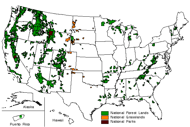
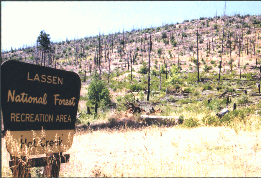 As part of the Sierra Nevada Forest Plan,
conservation groups, including American Lands, have urged the Forest
Service to:
As part of the Sierra Nevada Forest Plan,
conservation groups, including American Lands, have urged the Forest
Service to: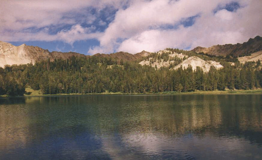
 Local conservation groups told the Forest Service in
September that they intended to file a lawsuit over the Flathead National
Forest's road reclamation program. Swan View Coalition and Friends of the
Wild Swan argue that the Flathead has illegally redefined what constitutes
a "reclaimed" road without also reinitiating formal consultation with the
Fish and Wildlife Service, which has the final say on the effects to
threatened and endangered species.
Local conservation groups told the Forest Service in
September that they intended to file a lawsuit over the Flathead National
Forest's road reclamation program. Swan View Coalition and Friends of the
Wild Swan argue that the Flathead has illegally redefined what constitutes
a "reclaimed" road without also reinitiating formal consultation with the
Fish and Wildlife Service, which has the final say on the effects to
threatened and endangered species.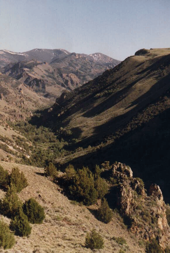 Mining is the greatest threat to the Humboldt
Toiyabe. There is great concern about the ongoing mine exploration near
Arc Dome and Mt. Jefferson Wilderness Areas. The major mines on the
Humboldt Toiyabe are the Griffon Mine, near Ely and Jerritt Canyon Mine in
the Independence Range.
Mining is the greatest threat to the Humboldt
Toiyabe. There is great concern about the ongoing mine exploration near
Arc Dome and Mt. Jefferson Wilderness Areas. The major mines on the
Humboldt Toiyabe are the Griffon Mine, near Ely and Jerritt Canyon Mine in
the Independence Range. 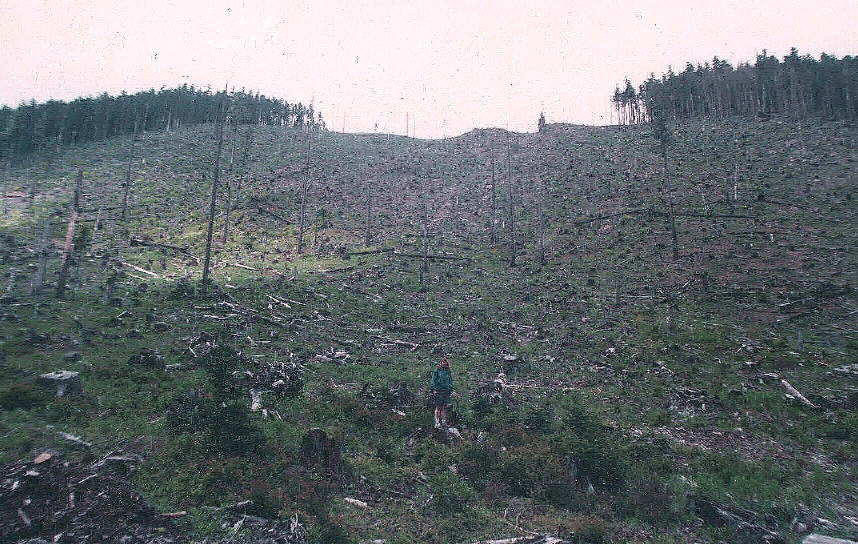
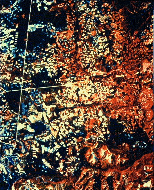
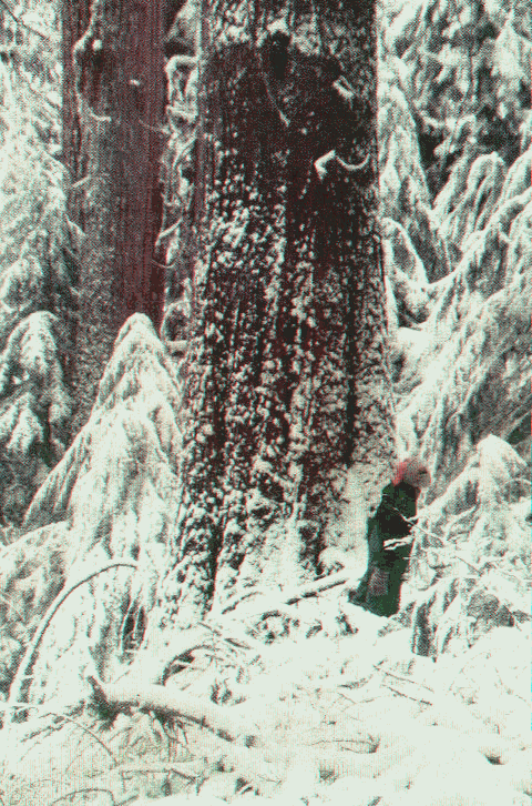 This year has been particularly bad for these Ancient
Forests because in addition to the normal programed liquidation of
old-growth, the Willamette has been assigned a great deal of "replacement
volume" timber sales. These sales are designed to replace volume that was
released by the Recissions Act Logging Rider (P.L. 104-19) in the Coast
Range but later found to violate the ESA. These replacement volume sales
must be of "like kind and volume" to the canceled rider sales.
This year has been particularly bad for these Ancient
Forests because in addition to the normal programed liquidation of
old-growth, the Willamette has been assigned a great deal of "replacement
volume" timber sales. These sales are designed to replace volume that was
released by the Recissions Act Logging Rider (P.L. 104-19) in the Coast
Range but later found to violate the ESA. These replacement volume sales
must be of "like kind and volume" to the canceled rider sales. 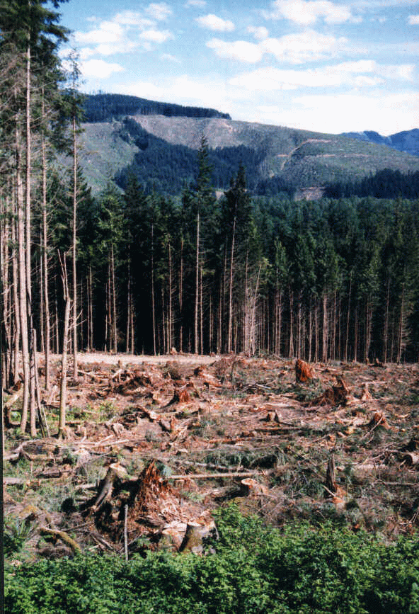
 The Forest contains rare wildlife including the
Puerto Rican Parrot, which is largely green in coloration, about 12 inches
long, and displays brilliant blue wings in flight. At close range a vivid
red forehead is also visible. Approximately 50 other bird species are
found on the Forest. Many species of lizards, crabs, and frogs, including
the unique "coqui" are found in abundance throughout the forest. The
Forest is a wildlife refuge; no hunting is allowed.
The Forest contains rare wildlife including the
Puerto Rican Parrot, which is largely green in coloration, about 12 inches
long, and displays brilliant blue wings in flight. At close range a vivid
red forehead is also visible. Approximately 50 other bird species are
found on the Forest. Many species of lizards, crabs, and frogs, including
the unique "coqui" are found in abundance throughout the forest. The
Forest is a wildlife refuge; no hunting is allowed.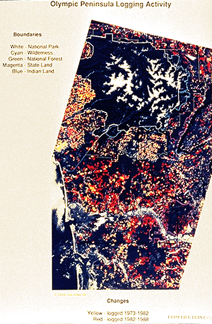 There is also increasing recreational use of the
forest, but too few personnel to prevent abuses by people dumping trash
and large appliances, or partying and tearing up campgrounds. The agency
is relying more and more on volunteers to carry out the needed work, but
staff aren=t available to design
volunteer projects or even supervise volunteers. Two districts currently
have lost their fish biologists, just as salmon issues become predominant.
There is also increasing recreational use of the
forest, but too few personnel to prevent abuses by people dumping trash
and large appliances, or partying and tearing up campgrounds. The agency
is relying more and more on volunteers to carry out the needed work, but
staff aren=t available to design
volunteer projects or even supervise volunteers. Two districts currently
have lost their fish biologists, just as salmon issues become predominant.
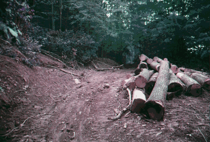 The Monongahela is threatened by excessive emphasis
on logging throughout the Forest at the expense of recreation and other
values. Budget and staff cuts have reduced programs for semi-primitive
non-motorized and other recreation.
The Monongahela is threatened by excessive emphasis
on logging throughout the Forest at the expense of recreation and other
values. Budget and staff cuts have reduced programs for semi-primitive
non-motorized and other recreation.